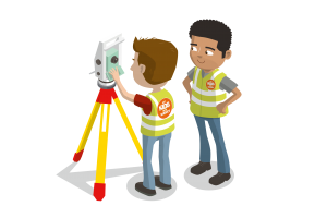
What is Surveying?
NOUN
- the profession or work of examining and recording the area and features of a piece of land so as to construct a map, plan, or detailed description of it.
“a chartered surveyor has acquired a practical knowledge of surveying” ·

Surveying has been around for hundreds of thousands of years. Surveyors and Engineers would have been used to build the Egyptian Pyramids and even to find the Titanic. A surveyor uses maths and geography as part of his or her tool kit.
Perfectly described by RICS “Surveyors keep traffic flowing, water running and people moving. They shape our roads, bridges and tunnels, our skyscrapers, stations and stadiums. They work in mines and in fields, on cliffs and on beaches. They value the houses we live in and the places we work in. They create safer homes and happier communities.
And they’re busy shaping our future too: helping to regenerate deprived areas and planning smart cities connected by the Internet of Things, while pioneering safer, more sustainable and more environmentally friendly building methods.
Surveyors work closely with a wide range of people: architects and engineers, bankers and ecologists, town planners and property developers. And they use the latest technologies: flying drones to map land and measure buildings, creating virtual reality models of buildings, and using Big Data to tackle global issues like climate change, migration and urbanisation.
There are more than 100 varied career roles across the surveying profession in three main sectors: construction and infrastructure; property; and land”.
Did You Know: In the 1860’s an English surveyor, William Matthew Flinders Petrie, surveyed the great pyramid in an evident attempt to show that its measurements were related to the English system of measurement and that the pyramids had been built in feet and inches.
How did surveying start?
There is some evidence of boundary surveying from as early as 1400 BC from along the valleys and plains of the Tigris, Euphrates, and Nile rivers. There is also a representation of land measurement on the wall of a tomb at Thebes which show the measuring of a grainfield with a rope with knots or marks at regular intervals (head and rear chainmen).
In 325 BC the Greeks had to use a long line to record distances along the coast. Useful for when they were making their voyages from the Indus to the Persian Gulf. The Greeks also possibly originated the use of the groma, a device used to establish right angles, however, Roman surveyors made this a standard tool.
Soon after the magnetic compass was brought in by the Arab traders. Followed by the astrolabe (measuring the altitudes and elevation of stars), the first odometer, the plane table, and the development of graphic triangulation and intersection. Read more on the history of surveying here.
If you’re looking for great education and fun content for your child to learn about the geospatial industry – find it here! Get Kids into Survey is owned and run by Elaine Ball Ltd. A team on a mission to #Getkidsintosurvey and to save the industry globally!


