
 North Atlantic Ocean 1985:
 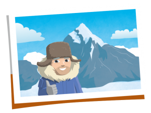 Mount Everest 1999:
 Please fill out the form below to access our Translation Options Hotsheet:
Surveying is one of the oldest professions in the world. It has occurred since humans built the first large structures.
Below are some examples, in history, of surveying:
- The almost perfect square shape of the Great Pyramid of Giza, built c. 2700 BC, is evidence of the Egyptians’ use of surveying.
- Stonehenge (c.2500 BC), in the South of England, was set out by prehistoric surveyors using “geometry” – from the Ancient Greek meaning “earth” “measurement”
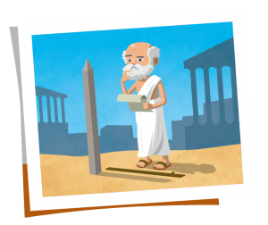 Eratosthenes was – amongst other things – one of the most important land surveyors of all time! Even though he lived over 2000 years ago – way before the time of scanners, satellites and sonar – he managed to work out the circumference of the Earth, the tilt of the Earth’s axis, and the distance from the Earth to the Sun!
He even made a map of the world with parallels and meridians, showing that he understood that the Earth was a sphere! And he worked all this out through measuring and comparing distances and angles on land. We think that makes Eratosthenes a Geo Survey Legend!
- The Romans recognised land surveying as a profession. They established the basic measurements under which the Roman Empire was divided.
- In the medieval period, groups of residents walked around their village to remind themselves of the boundaries. The group included people of all ages, the younger ones were there to make sure the ‘communal memory’ lasted as long as possible.
- In 1086, in England, William the Conqueror commissioned the Domesday Book. It recorded the names of all the land owners, the area and quality of land they owned and specific information of the area’s content and inhabitants.
- Mount Rushmore 1927: These giant sculptures were carved into the granite face of Mount Rushmore by Gutzon Borglum to commemorate four great American presidents. Three of them were also surveyors!
George Washington was made a county surveyor at the age of only 17 – just one year after going on his first survey expedition! He completed around 200 surveys and mapped about 60,000 acres of land.
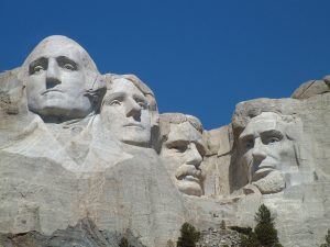
Thomas Jefferson came from a surveying family. He used his knowledge to help him make deals to buy land that quadrupled the size of the growing United States in the 18th Century.
Abraham Lincoln managed to become a surveyor after only six weeks of study. He would later use this knowledge to help him buy and sell land and invest in local areas.
Although the fourth president on Mount Rushmore, Teddy Roosevelt, wasn’t a surveyor, he did do some mapping in the Amazon!
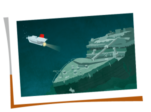
 North Atlantic Ocean 1985: An underwater archaeologist named Robert Ballard in his submarine (‘Alvin’), exploring the North Atlantic Ocean floor at a depth of over 12,000 feet… in which he discovered something incredible: the wreck of the Titanic! Ballard had previous experience mapping underwater regions using sonar technology, but this find would put him on the map as an intrepid underwater explorer! However, the really cool part of Ballard’s story was that his mission to locate the Titanic was actually a cover-up for a secret military operation to find and explore the USS Thresher and the USS Scorpion, two American nuclear subs that sank in the 1960s! This sneaky spy stuff makes Robert Ballard a super cool surveyor!
 Mount Everest 1999: Bradford Washburn was an expert cartographer, or map-maker, and the images he captured of remote and dangerous places are still used by climbers today. He used to hang out the side of a plane while his wife piloted; she would make daring fly-overs of treacherous areas while he snapped pictures from angles that no-one else dared to try and reach. In 1999, Washburn updated the official height of the world’s tallest peak – Mount Everest – to 8850m. He used special survey equipment to help make sure this reading was as accurate as possible… and he was 70 years old at the time! That makes Bradford Washburn a certified survey legend.