

Please fill out the form below to access our Translation Options Hotsheet:
Surveying Monopoly has been created with one big vision: to bring the world of geospatial surveying into a household game that families around the world can play, enjoy and learn from together. Across the board, real surveying and geospatial organisations are represented by their own unique characters, places and technology, showcasing just how varied and exciting the profession can be.
But who are the characters taking their places on the board, and what do they tell us about the real world of surveying? It’s time to meet them! Through a quick-fire Q&A, we’ll discover the inspiration behind each character, their favourite surveying tools, what their organisation does, and even where in the world they’d most like to survey.
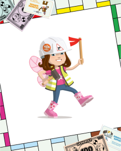
Let’s learn some more about Yazel Peebles & Associates character, Lillian:
 Company name and location?
Yazel Peebles & Associates, LLC. Based in Bedford, Texas USA
What is your name and what inspired your design?
My name is Desiree Hurst, and my children were the inspiration behind my design. Our company has always been incredibly family-friendly, and that became especially meaningful after my third, Lillian, was born.
During the baby formula shortage following COVID, I brought her to work with me for the first 10 months of her life so I could continue nursing and not have to rely on the limited supply of formula. She quickly became our “office baby” and was welcomed everywhere—from meetings and conferences to industry events and even a survey gala.
That experience reminded me that surveying isn’t just about maps and measurements—it’s about people, families, and building communities. My design reflects that spirit by celebrating both the profession I love and the importance of family.
What tool would you never leave the office or field without?
A shovel! While high-tech equipment like GPS and robotic total stations are essential, sometimes the most valuable tool is a shovel. Surveyors often have to dig to uncover historic property monuments that have been buried over time. Finding those original markers is like discovering hidden pieces of a puzzle—they help us retrace history, establish property boundaries, and connect the past to the present.
Which square on the surveying Monopoly board would your character most like to visit and why?
Acquisition Alley would definitely be my character’s favorite stop because that’s where every project begins. It’s where we start investigating the history of a property by researching deeds, plats, easements, and other historical records. Every piece of information helps tell the story of the land and uncovers clues that guide the rest of the survey. It’s like being a detective—solving a puzzle before ever stepping foot in the field.
What is the coolest thing about surveying that kids might not know?
One of the coolest things about surveying is that it’s involved in almost every development project from start to finish. Before a new neighborhood, school, park, shopping center, or roadway can be built, surveyors are there measuring the land and creating the maps that engineers, architects, and builders rely on. We help define property boundaries, collect important information about the land, and make sure everything is in the right place. Most people don’t realize that nearly everything around them started with a survey!
How does your company help surveyors measure, map, or build the world around us?
Our company is involved in every stage of the land development process, helping turn raw land into finished communities and commercial developments. We start by providing boundary and ALTA/NSPS land title surveys to support land acquisition, then collect topographic data that engineers and architects use to design the site.
As projects move forward, we prepare easement exhibits and descriptions, subdivision plats, and other survey documents needed for residential and commercial development. Once projects are complete, we perform as-built surveys to document the final layout of the site.
From the initial land purchase to the completed development, our surveyors provide the accurate measurements and mapping that serve as the foundation for successful land development.
If you could travel anywhere in the world to survey, where would you go?
If I could survey anywhere in the world, I’d choose a historic landmark or ancient monument. Places like St. Peter’s Basilica, the Colosseum, the Mayan pyramids, or other ancient ruins would be incredible to explore. I’d love the opportunity to study these remarkable sites up close, learn about their history, and use today’s advanced surveying and 3D scanning technology to document how they were built. Combining history, engineering, and modern technology to help preserve these landmarks for future generations would be an amazing experience.