

Please fill out the form below to access our Translation Options Hotsheet:
Surveying Monopoly has been created with one big vision: to bring the world of geospatial surveying into a household game that families around the world can play, enjoy and learn from together. Across the board, real surveying and geospatial organisations are represented by their own unique characters, places and technology, showcasing just how varied and exciting the profession can be.
But who are the characters taking their places on the board, and what do they tell us about the real world of surveying? It’s time to meet them! Through a quick-fire Q&A, we’ll discover the inspiration behind each character, their favourite surveying tools, what their organisation does, and even where in the world they’d most like to survey.
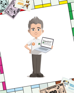
Let’s learn some more about TopoDOT Solutions character Professor Topo:
 Company name and location?
TopoDOT Solutions – Headquartered in sunny Winter Garden, Florida, with an amazing community of users and team members spanning all around the world!
What is your name and what inspired your design?
Professor Topo! He was inspired by TopoDOT’s relentless, curious spirit. We aren’t just software developers—we’re a team of “point cloud-obsessed nerds” dedicated to solving the world’s most complex spatial puzzles. Professor Topo embodies that love for exploration, learning, and teaching others how to unlock the power of 3D data.
What tool would you never leave the office or field without?
Our brain (and a healthy dose of curiosity)! High-tech lasers and fancy software features are awesome, but they’re just pieces of the puzzle. It’s critical thinking, smart workflows, and creative problem-solving that keep us at the cutting edge of modern surveying.
Which square on the surveying Monopoly board would your character most like to visit and why?
Definitely the Digital Twin Depot! We love putting surveyors right at the center of the action. The Depot is the perfect hub where raw data comes in, brilliant 3D deliverables go out, and the surveying community connects directly with the massive world of civil engineering and infrastructure. It’s where the real world and the digital world meet!
What is the coolest thing about surveying that kids might not know?
Modern surveying is basically real-life sci-fi! Instead of just using measuring tapes, we map the physical world using lasers, autonomous drones, high-tech cameras, and robotics. Surveyors get to use the world’s coolest technology because, in order to safely build or change the world around us, we have to precisely measure and understand it first.
How does your company help surveyors measure, map, or build the world around us?
We make the software that transforms billions of raw laser-scanned dots into highly accurate 3D models of roads, bridges, and buildings. TopoDOT provides surveyors with the industry’s best processing tools and the world’s only data management system built specifically for massive point clouds. Simply put: we help surveyors do more, work faster, and successfully map the world with incredible precision.
If you could travel anywhere in the world to survey, where would you go?
The Moon! There’s a whole lunar landscape waiting to be mapped. We’d love to unleash our AI Ground Extraction Tool on the lunar surface to automatically separate the flat dusty plains from the rugged craters and mountains, creating the ultimate 3D guide for the next generation of space explorers!