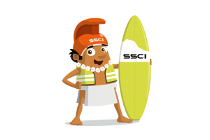
Introducing Kaha loa, our new fantastic sponsor Surveyors Supply Co Inc’s new character!

Company Name – Surveyors Supply Co. Inc.
Location – Waipahu, Hawaii, USA
Why did you get involved in Get Kids into Survey? A few years ago I saw the posters being handed out at our annual Hawaii Land Surveyors Conference and thought what a great idea. I was never taught anything in school about surveying and how important it is. The more we can do to promote the various areas of surveying the better. And the technology today is moving so fast making it more efficient and cooler! When my son came to work for us 5 years ago out of high school, he was unfamiliar with the work and never learned anything about it in school either. So he started learning the instruments and equipment and now trains companies how to use them. It has opened up a whole new world for him.
What do you do? We sell construction and surveying supplies and equipment around the Pacific islands.
How long have you been in the Survey Industry? Our company has been in business for 51 years.
How did you get into the Industry? My father-in-law started a business like ours in Alaska out of the need for wooden stakes to be used for building roads. No one was manufacturing them at the time so he stepped in and started to. He then started a retail business in Alaska. When this business opportunity became available in Hawaii he purchased it. That was 30+ years ago.
Funny Fact about the you – I will always eat hot french fries (chips) in the car while driving. A soggy cold fry is no good.
Favourite piece of kit and why? The brand new Leica GS18i, GNSS Receiver with Integrated Tilt Compensation & Imaging Sensor Allows you to Capture Data Quickly & Efficiently in Areas That Were Not Previously Possible with Conventional GNSS Equipment. Combines Point Cloud Data & GNSS Data Into 1 Georeferenced Image Group to Create a Detailed 3D Model of your Project Site Without the Need for a Laser Scanner or 3D mapping Device. It’s so efficient!
Favourite Survey technique and why? UAV LIDAR / Photogrammetric Mapping, Fastest & Most Efficient Data Collection Method for Large Scale Mapping Projects. Very Versatile & Allows for many Different Data Deliverables including georeferenced orthometric photographs & Digital Terrain Models. What a time saver!
Your website: www.surveyorshawaii.com
Character details; name, what does the character represent/ meaning behind it/him/her? Our characters name is Kaha loa (2 words) which is the Hawaiian name for “turn and then go straight for a long distance” . That pretty much sums up any Surveyors job.

