

Please fill out the form below to access our Translation Options Hotsheet:
Surveying Monopoly has been created with one big vision: to bring the world of geospatial surveying into a household game that families around the world can play, enjoy and learn from together. Across the board, real surveying and geospatial organisations are represented by their own unique characters, places and technology, showcasing just how varied and exciting the profession can be.
But who are the characters taking their places on the board, and what do they tell us about the real world of surveying? It’s time to meet them! Through a quick-fire Q&A, we’ll discover the inspiration behind each character, their favourite surveying tools, what their organisation does, and even where in the world they’d most like to survey.
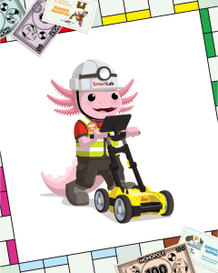
Let’s learn some more about SmartLab‘s character Tamachi, the surveyor axolotl:
 Company name and location?
Our company is SmartLab, based in Mexico City, Mexico. We specialize in surveying and geomatics solutions, supporting professionals with high-quality equipment, technical knowledge, and accredited laboratory services.
What is your name and what inspired your design?
My name is Tamachi, the surveyor axolotl. In ancient Mexico, “Tamachi” meant surveyor or “Who measures the land” in the local language (Nahuatl). My design was inspired by the Mexican axolotl, a unique and iconic species from Mexico, combined with the world of surveying. I wear field gear because I represent curiosity, precision, and the spirit of exploring and measuring the world around us.
What tool would you never leave the office or field without?
I would never leave without my GNSS receiver. It helps surveyors know exactly where they are using satellite technology, which is super important for mapping, construction, and field measurements. Of course, my helmet and safety vest are also a must!
Which square on the surveying Monopoly board would your character most like to visit and why?
Tamachi would most like to visit the GNSS / GPS square, because it connects surveying with satellites in space. It shows kids that surveying is not only about tripods and measuring tapes, but also about advanced technology that helps us locate points on Earth with amazing precision.
What is the coolest thing about surveying that kids might not know?
The coolest thing is that surveyors help build the world before construction even begins. Roads, bridges, buildings, tunnels, and even maps need accurate measurements first. Surveying is like giving the world a set of coordinates so people can design and build safely.
How does your company help surveyors measure, map, or build the world around us?
SmartLab helps surveyors by providing professional surveying equipment, technical support, and accredited laboratory services. We support tools such as total stations, GNSS receivers, levels, scanners, and other geomatics solutions that help professionals measure land, create maps, and develop construction projects with accuracy.
If you could travel anywhere in the world to survey, where would you go?
I would love to survey the ancient pyramids of Mexico, because they combine history, engineering, and mystery. It would be amazing to use modern surveying technology to better understand how ancient civilizations designed and built such impressive structures.