

Please fill out the form below to access our Translation Options Hotsheet:
Surveying Monopoly has been created with one big vision: to bring the world of geospatial surveying into a household game that families around the world can play, enjoy and learn from together. Across the board, real surveying and geospatial organisations are represented by their own unique characters, places and technology, showcasing just how varied and exciting the profession can be.
But who are the characters taking their places on the board, and what do they tell us about the real world of surveying? It’s time to meet them! Through a quick-fire Q&A, we’ll discover the inspiration behind each character, their favourite surveying tools, what their organisation does, and even where in the world they’d most like to survey.
Let’s learn some more about NSPS’s Evan the Eagle:
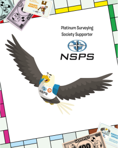 🦅 Company name and location
“Evan the Eagle here! I represent NSPS (National Society of Professional Surveyors), and I soar out of Frederick, Maryland—right in the heart of some amazing American surveying history and landscapes!”
🦅 What is your name and what inspired your design?
“My name is Evan the Eagle! I was inspired by the idea of having a birds-eye view, because surveyors need to see the big picture. Eagles soar high, just like surveyors use drones, satellites, and mapping tools to understand the land from above!”
🦅 What tool would you never leave the office or field without?
“I never leave without my GNSS receiver (GPS gear)! It helps me pinpoint exact locations anywhere I fly, whether I’m mapping a park, a neighborhood, or a brand-new bridge.”
🦅 Which square on the surveying Monopoly board would your character most like to visit and why?
“I’d swoop straight to ‘Satellite Positioning Technology’! From up high in the sky, I love anything that connects satellites with what’s happening on the ground. It’s like having super-powered navigation wings!”
🦅 What is the coolest thing about surveying that kids might not know?
Surveyors make the invisible visible! Property lines, underground pipes, future roadsyou don’t always see them, but surveyors map it all. It’s like unlocking hidden levels in a game!”
🦅 How does your company help surveyors measure, map, or build the world around us?
“NSPS helps by supporting surveyors with advocacy, education, standards, and keeping up with the latest technology. That means better tools, more accurate maps, and safer, smarter ways to build everything from sidewalks to skyscrapers!”
🦅 If you could travel anywhere in the world to survey, where would you go?
I would head to Machu Picchu in Peru! Imagine mapping ancient ruins high in the mountains—talk about legendary property status! Plus, with my wings, I’ve already got the high-ground advantage!”
“And for a bonus stop closer to home, I’d glide over to Mount Rushmore! Surveying those giant carved faces would feel like landing on a Monument Level-Up square. Big rocks, big history, and BIG surveying bragging rights!”