
Please fill out the form below to access our Translation Options Hotsheet:
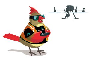
Welcoming McElhanney’s character Cartia Cardinal! Let’s learn some more about her:
 Company Name McElhanney
- Location We are headquartered in Vancouver, BC but have 30+ offices across Western Canada I can fly between!
- Why is it important for your company to help Kids Get into Survey? At McElhanney, we believe the world needs more curious minds who ask “How does this all fit together?” That’s what surveying is all about – understanding the land, connecting communities, and creating smarter, safer places to live.
By supporting Get Kids into Survey, we hope to open young eyes to the awesome adventures waiting in the geospatial world. The future of our industry depends on a new generation of diverse, talented, and empowered surveyors. And I’m here to help lead the way!
- What do you do? We map the world: from the skies, the ground, bodies of water, and even deep in the forests!
My team uses techy tools like GPS, drones, and lasers to measure the land and create maps that help people build stuff, protect nature, and plan for the future.
Basically, we’re part explorers, part scientists, and part puzzle-solvers. And yes, we sometimes get muddy!
- How long have you been in the survey industry? We’ve been proudly surveying for over 115 years! There’s always more to learn about the land beneath our boots – or claws, in my case!
- How did you end up getting into the geospatial industry? Well, it all started with one thing: CURIOSITY.
Ever since I was a little chick, I’ve loved flying high over forests, cities, rivers – you name it! I’d flap around wondering things like:
– Why does that road twist like that?
– Who built that bridge?
– How do people know where to put new houses, parks, or playgrounds?
One day, I spotted a group of surveyors working in a big open field. They had tripods, maps, lasers, and some gear that looked like it came straight out of a sci-fi movie. I perched on a tree nearby and watched for hours. They were measuring, scanning, marking points, even flying a drone! I thought, “Whoa. These people are like real-life adventurers and puzzle- solvers!”
So, I followed them and started learning everything I could about surveying and geospatial science.
That’s when it hit me: this is what I want to do!
I want to help people understand the land, make maps, explore the unknown, and build a better future. Plus, I already had a bird’s-eye view, so I figured: why not put it to good use?
- State a funny fact about you! One time I tried to land on a total station. I thought it was a fancy perch. It beeped and spun around 180 degrees, I squawked, and… let’s just say the survey crew laughed for days.
- Favorite piece of kit and why? Tough question—but I have to say… DRONES!
I mean, hello?! They FLY! Just like me! And okay, okay, they don’t flap their wings or sing in the mornings, but they’re seriously cool.
Let me tell you why I love drones so much:
When you’re surveying big areas – like forests, farms, or construction sites – it can take forever to walk around with measuring tools. But with drones, my human teammates can zoom high into the sky and take photos, videos, and super-precise measurements from above. It’s like giving your eyes a superpower!
And the best part? The drones collect data faster, safer, and in a way that’s really fun to watch.
Plus, drones are super helpful when the land is hard to reach, like steep hills, rivers, or remote communities. My team and I can use drone maps to spot cool features, measure distances, and even create 3D models of the land.
- Favorite survey technique and why? LiDAR scanning! LiDAR is like a magical laser that sees through the vegetation and tree canopy to find invisible things like hidden shapes in the land. The data turns into colorful 3D maps: like digital art, but sciencey!
- How did you choose the character and what does she represent? Mean to you? What’s her name? Well, my name “Cartia” comes from cartography – that’s the fancy word for making maps!
I’m a cardinal because we’re distinctly Canadian and known for our bold color and sharp eyesight: perfect for a surveying scout.
I represent all the curious, smart, nature-loving girls and boys out there who might not realize just how cool science and surveying can be. I’m here to show that your curiosity has wings!