
Please fill out the form below to access our Translation Options Hotsheet:
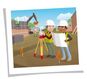 Building Survey, a familiar type of survey is one done on your home. It is often completed to assess the condition of a house before it’s bought. A building survey can look at any building’s construction and can work out if and how maintenance and repair needs to take place.
Land Survey is where ‘land’, which can be defined as ‘solid surface of the earth’, is measured and it’s details are recorded.
Construction Surveys help figure out where man-made objects such as highways and bridges as well as buildings and pipes should be located.
Utilities/Infrastructure Surveys measure services above and below the ground. Infrastructure means the structures and facilities needed for an organisation such as water and power lines.
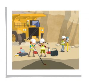 Mining Surveys explore and estimate material below the surface of the ground.
Hydrographic Surveys decide the geography of a body of water, including the depth, tide measurements, shoreline obstacles, and physical features of the body’s floor.
Aerial Surveys gather information and images from airplanes, helicopters or other aerial methods.
(Please Note: this is an open blog which will be updated and edited on a regular basis)