
Please fill out the form below to access our Translation Options Hotsheet:
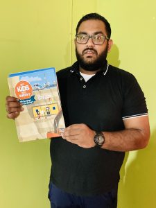
Welcoming Darion Mahadeo from Trinidad and Tobago:
 Where did you study? I am a Graduate Geomatics Engineer (Land Surveyor) in my country Trinidad and Tobago. I am a PhD Surveying and Land Information Candidate; I also hold an MSc. Geoinformatics (Distinction), and BSc. Geomatics (Honors)- Chartered Institution of Civil Engineering Surveyors Accredited. I also have 9 years of professional and academic experience.
All my degrees were obtained at the University of the West Indies (UWI), St. Augustine Campus, Trinidad, West Indies.
What are the requirements to be a surveyor in your area? To be a licensed surveyor in Trinidad, the first requirement is my accredited and recognized BSc. Geomatics Degree. And then I need a proposer who is a licensed land surveyor of Trinidad and Tobago (TTLS) who has been licensed for a minimum of 15 years. Then I need to work under him/her for a minimum of 24 months and complete the professional requirements necessary. Afterwards there will be an examination component, once passed the next stage is the trial survey, and finally once successful, the final stage is the oral defense (viva voce).
How did you get into surveying? Coming out of poverty was the main motivation of me being a surveyor. Education seemed to be the path that could deliver me out of this. However, it all started at the age of 10, seeing my dad who worked as a surveyor’s assistant struggle financially to make ends meet. Surveyor’s assistant in our country does not make as much of an income and having a family (wife and kids) was a great struggle. I wanted to be like my dad, but also be the ‘boss’ (surveyor) rather than a surveyor’s assistant – unlike my dad’s position.
The idea of being outdoors while working together for some days at the office was an attractive reward for the job also – this was the perfect mix for me considering my love for nature. I was then well-motivated, and nothing could have changed my mind, “I am going to be a surveyor”, was my motto from then. Browsing my way through academics, gaining working experience for the past 8 years helped me obtain proper insights within the field as to how they related to all things in the world.
Through my Department at UWI, which is an FIG Member, I was exposed to more in-depth sub-fields of the very broad ‘Geomatics’. Lots of theory made me very excited to pursue the upcoming practical assignments/fieldwork associated with learning new skill sets, and techniques. Having hands-on experience and the knowledge to execute made me more thrilled to learn more and more. I was starting to live my dream! I looked forward to the practical field trips such as cadastral surveys, engineering survey site visits, GPS and GNSS fieldwork, and even bathymetric surveys.
Years passed where I accumulated knowledge and skill sets in the fields of mathematics, cadastral surveying, hydrographic surveying, Geographic Information Systems (GIS), and Remote Sensing and then I applied them professionally. I am very skilled in conducting ground surveying techniques, developing GIS solutions, understand Remote Sensing Operations, and have a recent passion combining them with Artificial Intelligence to make smarter solutions for and informed decision making. All mentioned here are my interests in the field.
I have also taught courses of the BSc Geomatics at the UWI for some years between 2018-2021. Throughout the years, I have recognized surveying to be a well-respected and rewarding career. I tend to stay within this field and invest my youth towards contributing in whatever possible way I can. I aim to do good and make the world a better place. I aim to complete my PhD and be a Professor at a University someday as well as maintain Surveying and Geospatial practices in my work. I also aim to join professional organizations and attain professional certification to keep abreast with the technology and time.
How long have you been in the industry? I have been in the industry academically and professionally for 9 years.
Are you part of any associations or organizations you would like us to mention? At the moment I am just being responsible for my University (The University of the West Indies).
Why do you want to be a GKiS Brand Ambassador? To share knowledge and ideas with kids. To educate the younger generation (youths) about surveying and geospatial sciences. GKiS posters and incentives are well-designed and equipped for delivering these goals.
Why is it important for kids to know about surveying and the wider geospatial industry? So that they can have a fair idea of the field early in life and make more informed decisions as to what career they would like to choose. As well as to be more informed about surveyors (measurement scientists) and how important our roles are to the world.
What are you going to do as an ambassador for GKiS? I aim to follow the GKiS initiatives:
-> to spread the word of the ‘Get Kids into Survey’ Initiative in local area
-> to attend careers fairs, school classrooms & conferences
-> to present surveying as a career to young students
-> to encourage others to join as Brand Ambassadors and help spread the word
-> to educate potential Brand Sponsors about our initiative
-> to feedback to ‘Get Kids into Survey’, with what school/fair/event has been attended etc.
What are your hobbies? Football (soccer), Agriculture, playing with my puppies, spending time with animals and nature, and teaching children, young people and adults.
If you/your company had a GKiS character, what would it be? I would like to be a mini version of myself – a little lad who has the world as his oyster (and chose surveying as a start).
What resource would you like to see next from GKiS? Animation and audio -> video of the characters (maybe Ambassadors do voice overs) 🙂
Anything else you want to add that you think our audience (surveyors, teachers, parents) would be interested in? Share widely with the GKiS organization and spread the word!