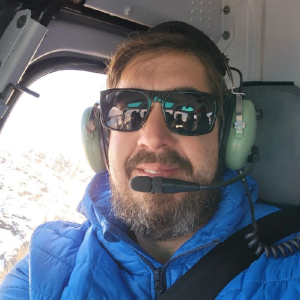
Introducing our latest Brand Ambassador Aaron Michalenko from Phoenix, Arizona, USA:
 Where did you study? I pursued my studies at Glendale Community College (A.A.S. in CAD Technology) and also at Phoenix College (A.A.S. in Land Surveying). During my time at these two colleges, I was deeply fascinated by land measurement and decided to specialize in cadastral surveying.
What are the requirements to be a surveyor in your area? In some areas, to become a licensed cadastral surveyor, you typically need a bachelor’s degree in surveying or a closely related field. Then, you must complete several years of work experience under a licensed surveyor and pass a licensing exam. Arizona does not require the bachelor’s degree, but did accept my college years as a comparable 4 years of schooling, which was really cool of them.
How did you get into surveying? While at Glendale Community College, I came across a group of students working on a cadastral project. Back then, I thought I wanted to be an Architect. The student’s work intrigued me, and it also had elements of Architecture in the courses, so I switched my focus to surveying. I’ve always had a keen interest in understanding and organizing data, and surveying provided a perfect blend of data, technology, and outdoor work.
How long have you been in the industry? I’ve been in the surveying industry for over 20 years now.
Are you part of any associations or organisations you would like us to mention? Yes, I am a proud member of the American Congress on Surveying and Mapping (ACSM) and the National Society of Professional Surveyors (NSPS).
Why do you want to be a GKiS Brand Ambassador? I believe in the potential of the younger generation. Being a GKiS Brand Ambassador would allow me to inspire them, showcasing how the geospatial industry can impact the world. Given my background and passion, I believe I can make a significant contribution.
Why is it important for kids to know about surveying and the wider geospatial industry? Understanding our world begins with understanding its dimensions. Surveying and geospatial sciences help us understand our environment, plan our cities, and protect our natural resources. It’s essential for kids to know about this, as they’ll be the ones to shape our future landscapes.
What are you going to do as an ambassador for GKiS? I’ll leverage my platform to raise awareness about surveying. By hosting workshops, collaborating with schools, and using technology, I aim to make geospatial sciences more accessible to the younger generation.
What are your hobbies? I love learning new things. Recently, I’ve started to teach myself how to create video games.
If you/your company had a GKiS character, what would it be?
Here are 10 options I like:
RiseRyder: A phoenix rising from a cityscape, embodying transformation and rebirth. Its wings showcase urban graffiti art, while it holds a digital GPS in its talons.
MetroMaverick: A cool, urban fox wearing sneakers and a snapback. This character is all about navigating both the challenges of the city streets and geospatial sciences.
RebelRadar: A street-savvy hawk with tattoos of coordinates on its wings, symbolizing a sharp vision that overcomes adversity.
NeonNomad: A chameleon that changes its colors to neon street art, holding a holographic map. Represents adaptability and modern tech vibes.
GraffitiGeo: A lion prowling the urban jungle, its mane adorned with colorful street art and it holds a laser scanner, representing strength and precision.
TechTideTurner: A dolphin equipped with sonar tech and VR goggles, symbolizing the leap from troubled waters to mastering modern geospatial tools.
PulsePioneer: A wolf with a digital heartbeat line running through its fur, holding a drone, representing the pulse of modern city life and tech innovation.
StreetSavvySatellite: A futuristic robot with traces of paint splatters, symbolizing the blend of street culture and high-tech geospatial advancements.
EchoElite: A panther with sound waves echoing from its paws, symbolizing the journey from unheard cries to making a significant mark in the world, all while holding a modern rangefinder.
UrbanUprising: A deer with antlers shaped like city skyscrapers, holding an augmented reality tablet, symbolizing growth, and the rise from challenges.
What resource would you like to see next from GKiS? I’d love to see an interactive app or platform where kids can virtually experience the world of surveying, perhaps with augmented reality to bring the concepts to life.
Anything else you want to add that you think our audience (surveyors, teachers, parents) would be interested in? Surveying isn’t just about measuring land; it’s about understanding our world and ensuring that we leave a sustainable environment for future generations. Encourage the young minds around you to explore, question, and delve into the geospatial realm. The future of our world depends on it.

