

Please fill out the form below to access our Translation Options Hotsheet:
Surveying Monopoly has been created with one big vision: to bring the world of geospatial surveying into a household game that families around the world can play, enjoy and learn from together. Across the board, real surveying and geospatial organisations are represented by their own unique characters, places and technology, showcasing just how varied and exciting the profession can be.
But who are the characters taking their places on the board, and what do they tell us about the real world of surveying? It’s time to meet them! Through a quick-fire Q&A, we’ll discover the inspiration behind each character, their favourite surveying tools, what their organisation does, and even where in the world they’d most like to survey.
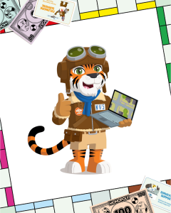
Let’s learn some more about NV5‘s character TopoTiger:
 Company name and location? NV5 Geospatial. We’re proudly based in the United States, but our adventures, and our projects, span the globe with more than 100 offices supporting work across Europe, Asia, India, and the Middle East. If it’s on the map, chances are we’ve helped measure it!
What is your name and what inspired your design? TopoTiger – part tiger, part topography expert! “I was designed to bring together the wild curiosity of exploration with the precision of geospatial surveying. With my pilot helmet and mapping tools, I’m always ready to take to the skies, capture data, and help turn the world into something we can understand, map, and improve.”
What tool would you never leave the office or field without? “My go-to gear is a GPS-enabled phone with a camera. Why? Because in geospatial work, location is everything, but context is what makes it powerful. Photos and data together help us tell the full story of a place, from what’s there to what it means.
Which square on the surveying Monopoly board would your character most like to visit and why? “I’d land on the Aerial Mapping Zone every time! That’s where I can fire up my plane, capture high-resolution imagery, and map entire cities in a single flight. From up there, I get the full picture, and that’s where the magic happens.”
What is the coolest thing about surveying that kids might not know? “Here’s a cool secret: surveyors help build the future before anything is even built. From roads and airports to video game maps and disaster response planning, surveyors create the foundation for everything. If you’ve ever used a map app or played an open-world game, you’ve seen surveying in action!”
How does your company help surveyors measure, map, or build the world around us? “At NV5 Geospatial, we use some of the most advanced tools out there; lidar, aerial imaging, GIS, and mobile mapping systems to capture incredibly detailed data about the real world. We turn that data into maps, models, and insights that help engineers design safer infrastructure, help cities plan smarter, and help communities grow stronger.”
If you could travel anywhere in the world to survey, where would you go? “I’d love to map the Amazon Rainforest from above! It’s vast, complex, and constantly changing. Using top-tier geospatial tech, we could help monitor ecosystems, track environmental changes, and protect one of the most important places on Earth.”