
 How did you get into surveying? I went to school for aviation where I discovered the extent of the drone industry and its applications for mapping. My start was in multispectral mapping for agriculture using drones. I then moved to the defense industry and now work in the survey and mapping industry. I have a passion for collecting accurate data to create maps that are able to direct decisions and help planning efforts.
 How did you get into surveying? I wanted to be an engineer. I started out down that path right after high school. I was working at the Civil Engineering firm as a draftsman at 17 when one of the Surveyors had a medical incident and was put on a medication where he couldn’t drive. At the time, I was basically the cheapest labor in the office so they made me be his chauffeur. Once i started going out into the field with the Surveys, it bit me like a bug and the rest is history.
 How did you get into surveying? I have been a surveyor since 1991. My first job was as a land surveyor. I have traveled around my country carrying out different topographical infrastructure projects. I have been president of the Colombian Society of Surveyors and I am currently serving as president of the Tolima Society of Surveyors. I have been a teacher of Computer Aided Design, Technical Drawing and Geographic Information Systems.
 How did you get into survey? I studied Earth Science at undergrad level, then worked at a consultancy doing a lot mapping tasks using geographic information systems (GIS), I moved into managing offshore surveys and survey data interpretation, initially for oil and gas projects, then mainly offshore renewables projects.
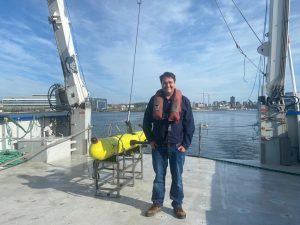 How did you get into surveying? I was always interested in deep water exploration and survey so I attended Liverpool John Moors University and Studied BSc (Hons) Maritime Studies.
 How did you get into surveying? I started in 10th grade in a technical drawing workshop. Our instructor was a surveyor.
 How did you get into the geospatial industry? After studying for a BA Honours degree in Graphic Design at University for the Creative Arts, I decided to change career completely. Geomatics surveyors work outdoors, and the role offers considerable opportunities for travel which also appealed to me!
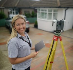
Please fill out the form below to download our Monopoly Sponsor Info Sheet Download:
Introducing JEP by Orcutt! Let’s learn some more about them:
 JEP, short for “Just Every Point” is a state-of-the-art survey robot designed to assist Land Surveyors in their precise and demanding work. Equipped with advanced sensors, GPS technology and cutting-edge mapping tools, JEP’s primary mission is to measure, record, and analyze every corner of the land it surveys with unparalleled accuracy.
JEP was created by Orcutt Survey Company to take on the heavy lifting of fieldwork, such as marking boundaries, measuring elevations, and scanning vast terrains for data collection. Although JEP is highly intelligent, it doesn’t shy away from its playful side. As it moves through dense forests, rocky hills, or urban landscapes, JEP’s programming often leads it to express curiosity, checking out new landmarks and not to mention JEP’s killer sense of humor and consistent ribbing of local engineers and architects.
JEP continues to be on the cutting edge of robotic surveying, always evolving with new technology to meet the ever-changing demands of land survey professionals. Stay tuned to Get Kids Into Survey for JEP’s latest developments from drone surveying to bathymetric surveys. JEP is an old robot learning new tricks every day.