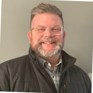
Welcoming Schuyler van Pelt covering the North East Region of Massachusetts, USA:
How did you get into surveying? I began my career as a site civil engineer, quickly taken under the wing of a land surveyor within our firm. From that point on with a passion to learn this new less well know side of the industry it was starting from scratch at the bottom of the totem pole and climbing the learning curve to be a valued land surveyor for the firm and for the industry as a whole.
What are your plans as a Brand Ambassador? I hope to work with the program to bring attention to the industry not just at the younger ages, but additionally promote opportunities within the engineering departments in the continuing education atmosphere. As a former engineer going through an ABET program, I believe more awareness can and should be drawn to geospatial/geomatics type work as well as look to promote survey internships, an industry we see covered by engineering internships in an indirect form that I feel may drive more competition and engagement if branded correctly
Tell us a bit about what you do: I currently work as a land surveyor on the South Shore of Massachusetts, siding in site civil design projects. Our survey department handles everything from ALTA’s and lotting plans to construction layout and as-builts. I’ve began to adopt a more hybrid role between office technician and crew chief in the field but will always look forward to a good day in nature.
Anything else you’d like to add? Having worked as a tutor in the past, I hope to bring a skillset of both effective education but also an empathetic and relatable approach to the next generation of surveyors to not just teach them material but apply it to current experiences and drive engagement through fascination.
Ambassador Spotlight ‘John Chwalibog’
Welcoming John Chwalibog our latest Brand Ambassador from Michigan, USA:
How did you get into surveying? Started surveying while still in school and ended up working for Carl Zeiss (survey), Trimble, FARO, Matterport and Ceinsys. We also had our own 3D Reality capture business for 7 years before selling to Ceinsys.
What are your plans as a Brand Ambassador? Great question, but we work with a charity in Detroit and one of the big things we do is a career day. Would love to expose all those kids (4th through 12th grade) to these professions and leverage what GKIS has created to do that
Tell us a bit about what you do: We capture assets for telecom and utilities in 3D
Ambassador Spotlight ‘Emily Bann’
Introducing Emily Bann our latest Brand Ambassador covering Lewiston & Clarkston areas of Idaho, USA!
How did you get into surveying? I at first went to school for engineering tech work, while doing that you have to do some survey in the mix. I loved it, I then went to Washington D.C. for the student conference and had an internship after my first year, I instantly fell in love with it, I then decided that is what I wanted to pursue! I then got offered a part-time position at my internship job, I am now full-time and still working towards my bachelor’s at ISU.
What are your plans as a Brand Ambassador? My plans are to get kids knowledgeable about geospatial careers, growing up here I know we didn’t get talked much about these careers it was only engineering, doctor, nurse, vet, etc. I want to spread the good word about our field, and I feel we may start the love for geospatial early on. My daughter already finds my job fascinating and always asks me when we pass construction sites if I worked on it. She’s 5 and is already interested in what I do! I feel also being a woman in the field may push other girls to not feel afraid to join into it as well.
Tell us a bit about what you do? I do anything to fieldwork to computer stuff. When we are first starting a project one of my tasks is to do the research to get deeds, records of survey, plats, and CP&F’s then in CADD cogo in the parcels and place search points for the field crews. For fieldwork we do topo, boundary, construction, storm drainage/basin verifications, and FEMS elevation certs. I work on civil 3D to create existing conditions maps, control maps, stake sheets, and figure out boundaries, I also work in Trimble business center to move our data to the OPUS solution. Even though I don’t get to do it at my current place of work I love to work in ArcGIS, it’s so much fun having to do mapping!
Besides working and school I have a daughter I get the joy of raising.
Ambassador Spotlight ‘Frédéric Baril’
Welcoming Frédéric Baril our latest Brand Ambassador from Quebec, Canada! Let’s learn some more about him:
How did you get into surveying? I love technology, science, and math, which is why I became a land surveyor! 📏
What are your plans as a Brand Ambassador? I’m passionate about education and committed to promoting my profession. In addition to my work as a land surveyor, I dedicate myself to raising awareness of this profession among young people at various events. 🎓
I’m also part of the Innovators of the Technoscience Network, a network I absolutely love! 💡 I’m also a mentor for Academos. 🧑🏫
Currently, I offer a conference on the profession of land surveying and the field of geomatics, specifically designed for high school students. It’s called La Géomatique. La Géomaquoi? 🎥 I am now a registered Canada Lands Surveyor (C.L.S)!
As an ambassador for Get Kids Into Survey, even though I mainly speak and present in French, I want to introduce young people to the world of Get Kids Into Survey by incorporating various digital resources and tons of information on the geospatial field into my conference. 🌍 I want to show them that, yes, there is a lot of information in English, but it’s incredibly relevant and exciting for them! 🌟
Tell us a bit about what you do? My life at work…
Fieldwork
The first step in my job is to give instructions to a team of technicians about the special details of a project. If I don’t go to the field myself, I need to do something called immediate monitoring. This means I check what’s been done while I was away, either by looking at photos or notes taken by the technicians.
In the field, we use very advanced and precise instruments to collect all the information we need for my later analysis. 📋👨💼🔍
Research
The second step is research. This involves a lot of things. I need to look for information about the history of the land, read old maps and legal documents from the 1800s, newer plans, and documents about rules for buildings, landslide zones, and flood zones. In short, I check a bunch of sources to find very specific information that will help me in the next steps. 📚🔍📜
Analysis and Opinion
The third step is analysis. This is when I put everything together: what was measured in the field in step one and what I found during research in step two. This is when the math, science, and problem-solving come into play. The first task in this step is to give my opinion about property boundaries. What does that mean? It means I have to figure out exactly where a piece of land is, using math and science based on all the documents I have.
Once I give my opinion about the boundaries, I need to apply all the rules and laws I found during my research. Is there a flood zone? Yes, I’ll show it on the map! Is the house too close to the road? Yes, unfortunately. I’ll mention it in my report! 🏡📐📝
Documents and Advice
This step is the heart of my work, and that’s why I’m part of a professional order. The documents I create, like the property certificate I mentioned earlier, are special documents only professionals like me can make.
This is also when the advice part of my job comes in. I advise my clients on what steps to take to solve their problems, complete their projects, or explain my findings in the documents and why I made certain decisions. 💼📄🔍
Anything else you’d like to add? What exactly is a land surveyor in Quebec?
You’re kind of like a detective for land. When someone wants to buy a piece of land, you do research to check if there are any problems with it.
You use special tools to take measurements, check if the land’s dimensions are correct, and make sure people aren’t taking up more land than they should.
This is super important because, for many people, buying land or a house is the biggest purchase of their life. They need to know if everything is good to go. You also check if, for example, the house is placed correctly on the land, if it’s not too close to the road, or if the pool isn’t too close to the neighbor. All these things are governed by rules and laws. 📜🔍🏡
Now, what’s the name of the key document that covers all of this? It’s called the “certificat de localisation” (certificate of location)! What’s it for? It’s a very important document used when selling land or a house. It’s kind of like when you go to the doctor for an annual check-up. 📝
The certificat de localisation is the health report of a piece of land. In this document, you show the land, the buildings, natural features, and more. The certificat de localisation also includes a report where you talk about different points you need to check.
It’s a document that protects people, especially during a land or house sale. 🛡️
So, that’s one of the things you can do in your job. 🌟
Ambassador Spotlight ‘Frederick Dyste’
Introducing Frederick Dyste our latest Brand Ambassador from California, USA. Let’s learn some more about him:
How did you get into surveying? My company, BizWatt LLC, is the creator of Qfactor for Surveyors, a surveying project management application we started almost 9-years ago.
What are your plans as a Brand Ambassador? To continue our current level of support as well as setting up a table at Orange County (CA) and other Southern California CLSA chapter events. There is a multi-chapter CLSA event at Cal Poly Pomona on March 6th, 2025 with Jay Seymour speaking on the Profession Career of Land Surveyor. Perfect opportunity.
Tell us a bit about what you do? I engage with land surveying business owners across the United States and globally on a daily basis. We promote GKIS in several ways; through email campaigns, on our marketing websites (https://bizwatt.com/mentoring-youth/) and by offering specials for surveyors who sign up for our services. We contribute $100 of their setup fees to GKIS in their name.
Anything else you’d like to add? I’ve been asked to speak at high schools in Santa Barbara county about entrepreneurship and I always bring up surveying as a career choice. I’ve worked in construction many years ago and never thought about surveying as a career. Now that I’ve been working in he industry for 9-years I see it as a great career choice. In fact I am trying to find a summer internship for my college age daughter.
Our company hires college students studying surveying as our support team. We look forward to the day a Qfactor team member gets hired by a surveying company.
Ambassador Spotlight ‘Tabuson Sharifu Nigo’
Introducing our latest Brand Ambassador Tabuson Sharifu Nigo who is from Uganda, Africa:
How did you get into surveying? I have gotten into geospatial industry through attending 4 years Bachelors Degree program with Ndejje university in Uganda under the faculty of Engineering and Survey in the Department of Geomatics
What are your plans as a Brand Ambassador? I’m looking forward into spreading and teaching the younger generation the information regarding the impacts that will be brought by open geospatial knowledge and spreading the news about GIS at large within locally where my community within is more prone to and globally.
Tell us a bit about what you do: Am a graduate land surveyor and geomatics Engineer with current residence in Uganda. As a pasionate geosptial engineer, I work with Open Street Map Uganda(OSM_UGANDA) and Humanitarian Open Street Map as a contributor in mapping and adding places affected by disasters on Map such that incase calamities arise, such places must be having a geospatial aspect and location known onto Map and during my time at Campus, I leant about YouthMappers community which is an association of university led geospatial community operating worldwide and with the research I carried out, I founded one YouthMappers community for Ndejje University with the names SPATIAL MAPPERS NDEJJE UNIVERSITY in September 2023
Anything else you’d like to add? With the foundation gotten from YouthMappers Community from Spatial Mappers Ndejje University & Open Street Map Uganda as a Chapter Founder in 2023 and OSM contributor in 2022 respectively, I’m looking forward in teaching and spreading the news about Surveying and Geomatics engineering in broader scope and i have started teaching GIS to other professionals already, and been taken for a 4 years Bachelors degree for the Geomatics Engineering, I believe I will serve my Community to the best and will be well represented because I am a leader and personally carry on and do a lot of research with which I believe my community will benefit from majority of the students did not learn about Geospatial
Character Spotlight ‘Juliano Associates’
Welcoming our new Brand Sponsor Juliano Associates to the Get Kids into Survey family! Let’s learn some more about them:
Company Name: Juliano Associates
Location: Wallingford, Connecticut, USA
Why is it important for your company to help Get Kids into Survey? Let’s face it, our profession is aging out, and our numbers are dwindling year after year. Add to that the loss of university programs and the fact that most people have no idea what surveyors truly do. This program allows us to get in front of the future generations to expose them to what this profession has to offer and how rewarding it truly can be.
What do you do? Juliano Associates focuses on land development projects and residential boundary surveys throughout Connecticut. My title says I am the managing partner, but that is just a fancy way of saying I do anything and everything around the office that needs doing.
How long have you been in the survey industry? Well, since my father started the company in the basement of the family home in 1973, I would say just about all of my life. But officially my career began the summer of 1992 when I graduated from UCONN and started working full time.
6. How did you end up getting into the geospatial industry? I started my career as a civil engineer wanting to focus on design work, as I felt then that this was where professional recognition would come from. My father was more than happy to turn over the engineering work to me and focus on the survey side of the business. As I got older, I began to see just how wise my father was and why he was more than willing to let me handle the day to day engineering. As I started to run the business more and more, I hired young engineers that were hungry for design work which afforded me the opportunity to focus on surveying. I have never looked back.
State a funny fact about you… No lie, I was suspended from school for a day for fighting when I was thirteen years old. There was no way my father was going to let me stay home where I could lounge around watching television all day. Instead, he dragged me to work and had one of his employees take me to a project where they were setting up targets for a large aerial survey. I got to paint white crosses on roads and parking lots and place pre-made cloth crosses in open fields, all while hiking around for hours in the woods as well. His idea of punishing me ended up being a pretty good day.
Hmmm, maybe this should have been my answer for how I got into the geospatial industry!
8. Favourite piece of kit and why? Definitely our Carlson GPS units. We bought our first receiver in 2013 not realizing how much we would be using it in our day to day operations. They have definitely transformed the way we do things in the field, from being able to set all our surveys on state plane coordinates to increasing the amount of accurate data that can be collected in a typical day.
9. Favourite Survey technique and why? My favorite technique is sitting down after all of the data has been gathered and working on the process of reconciliation between the physical evidence, the record maps, and deeds. There is nothing more satisfying then putting the puzzle of a parcel boundary together.
11. How did you choose the character and what does he/she/it represent? Mean to you? What’s his/her name? It may look like I am walking my dog, Daryl, but trust me when I say he is the one leading the way. Daryl is the backbone behind the company. He thoroughly enjoys welcoming everyone to the office and makes sure to point out where his cookies are located. He is lovingly referred around the office as HR. He knows just when to get you to chase him around the map table or when you need to take a break and give him a belly rub. He is very intuitive about these kind of things! He has been known to fall asleep on people’s shoes under the conference table if a meeting is running long. Just don’t mind the bubbles and drool if you happen to be eating something around him.
Ambassador Spotlight ‘Rocky Richardson III’
Welcoming Rocky Richardson to the Get Kids into Survey Brand Ambassador group! Covering Stanislaus County and surrounding areas, California, USA:
How did you get into surveying? My father owns and operates a full-service land surveying firm in Oakdale California. And I’ve been surveying since I could walk. I love the industry.
What are your plans as a Brand Ambassador? To shed light on the industry and help cultivate the next generation of land surveyors and geospatial technicians.
Tell us a bit about what you do? I handle day to day operations, draft record maps, handle construction calculations, and handle field work.
We use cookies on our website to give you the most relevant experience by remembering your preferences and repeat visits. Read More.
This website uses cookies to improve your experience while you navigate through the website. Out of these, the cookies that are categorized as necessary are stored on your browser as they are essential for the working of basic functionalities of the website. We also use third-party cookies that help us analyze and understand how you use this website. These cookies will be stored in your browser only with your consent. You also have the option to opt-out of these cookies. But opting out of some of these cookies may affect your browsing experience.
Necessary cookies are absolutely essential for the website to function properly. This category only includes cookies that ensures basic functionalities and security features of the website. These cookies do not store any personal information.
Any cookies that may not be particularly necessary for the website to function and is used specifically to collect user personal data via analytics, ads, other embedded contents are termed as non-necessary cookies. It is mandatory to procure user consent prior to running these cookies on your website.
Monopoly Sponsor Info Sheet Download
Please fill out the form below to download our Monopoly Sponsor Info Sheet Download:
Autumn Poster Hotsheet Download
Please fill out the form below to access our Poster Hotsheet:
Summer Poster Hotsheet Download
Please fill out the form below to access our Poster Hotsheet:
Spring Poster Hotsheet Download
Please fill out the form below to access our Poster Hotsheet:
Poster Hotsheet Download
Please fill out the form below to access our Poster Hotsheet:
Re-Print Hotsheet Download
Please fill out the form below to access our Re-print Hotsheet:
Winter Poster Hotsheet Download
Please fill out the form below to access our Poster Hotsheet:
Homework Project Info Pack
Please fill out the form below to access our Homework Project Information Pack:

 How did you get into surveying? Started surveying while still in school and ended up working for Carl Zeiss (survey), Trimble, FARO, Matterport and Ceinsys. We also had our own 3D Reality capture business for 7 years before selling to Ceinsys.
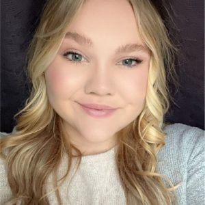 How did you get into surveying? I at first went to school for engineering tech work, while doing that you have to do some survey in the mix. I loved it, I then went to Washington D.C. for the student conference and had an internship after my first year, I instantly fell in love with it, I then decided that is what I wanted to pursue! I then got offered a part-time position at my internship job, I am now full-time and still working towards my bachelor’s at ISU.
 How did you get into surveying? I love technology, science, and math, which is why I became a land surveyor! 📏
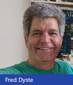 How did you get into surveying? My company, BizWatt LLC, is the creator of Qfactor for Surveyors, a surveying project management application we started almost 9-years ago.
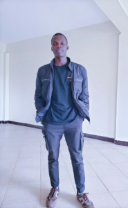 How did you get into surveying? I have gotten into geospatial industry through attending 4 years Bachelors Degree program with Ndejje university in Uganda under the faculty of Engineering and Survey in the Department of Geomatics
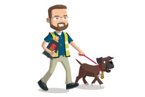 Company Name: Juliano Associates
 How did you get into surveying? My father owns and operates a full-service land surveying firm in Oakdale California. And I’ve been surveying since I could walk. I love the industry.
 How did you get into surveying? I began my career as a site civil engineer, quickly taken under the wing of a land surveyor within our firm. From that point on with a passion to learn this new less well know side of the industry it was starting from scratch at the bottom of the totem pole and climbing the learning curve to be a valued land surveyor for the firm and for the industry as a whole.