

 Company Name – Position Partners
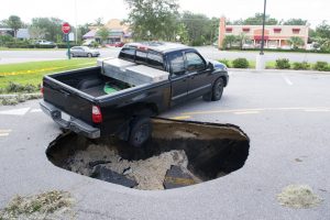
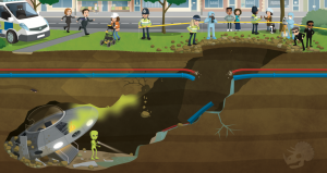 Having set the scene, pupils were given a sneak peek at what lay beyond the entrance to the crater, via the
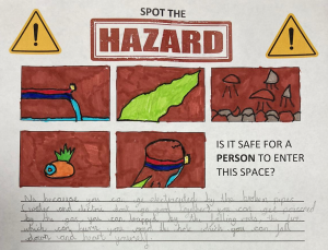 The group managed to identify five separate hazards that might make the crash site a no-go area for the investigators. They noticed that the broken utility pipes posed a problem – especially with the potentially catastrophic combination of electricity and water. They noted that the strange green smoke floating up through the cavity might well be toxic, and that where there is smoke, there is likely fire – just like the one on the alien’s ship! The group also identified the crumbling rocks as a hazard; one that could crush an investigator or cause a cave-in that would trap them underground. Finally, they identified the crater itself as a fairly hefty fall risk! All in all, the group agreed that it would not be safe for a person to enter the space… So how would the investigators ever find out what was down there?
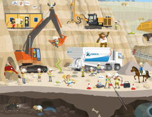 Using the
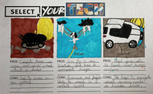 The pupils noticed that, in the poster, there were three mobile mapping systems: one where the LiDAR scanner was mounted to a robotic vehicle; one where a scanning device was fixed to a drone, and one where a LiDAR unit was mounted to a 4X4 vehicle. The pupils were asked to generate pros and cons for each of these systems in the context of exploring the underground tunnel from the street scene.
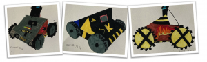
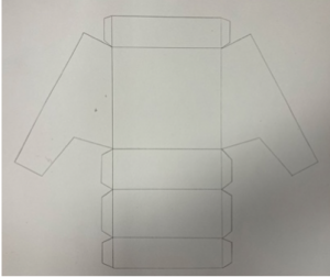
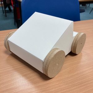
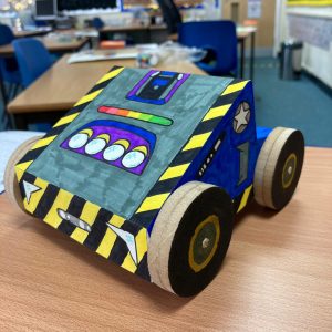
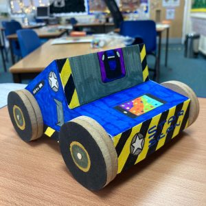
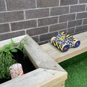 The result of the groups’ creative efforts was a set of prototype vehicles that looked like they could take on any survey situation, no matter how out-of-this-world it was! The children even took their models outdoors to put them through their real-world paces…
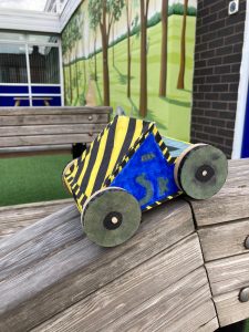 To round-off the project, the group used their drama skills to enact the discovery of the alien ship, and the reactions of the various people in the original scene. The pupils enjoyed the Shared-Space Invaders project immensely, and through the imaginative Get Kids into Survey stimuli, and a creative, cross-curricular teaching approach, they learned a great deal about cutting-edge professional technology, hazard safety, and the fascinating world of underground survey.
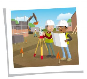 Building Survey
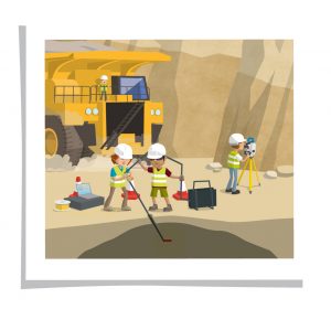 Mining Surveys
 Company Name: UPG
 Our character is a Tasmanian Devil. This is a uniquely Australian animal found only on the Australian Island of Tasmania. The Devil is currently under threat due to a genetic disease. By providing access to an accurate and reliable positioning capability, researchers will be able to better track the movements of these amazing creatures to understand their behaviours and help keep the remaining populations safe for generations to come.

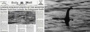 We began with a literary leap into the mythology of the Loch Ness Monster. From its first alleged sighting by St. Columba in 565 CE, to the famous ‘Surgeon’s Photograph’, to a set of strange sonar readings and the alleged sightings on Apple maps. Each account compounded the mystery surrounding the creature. There were so many sightings, so much apparent evidence, but there were also a whole host of hoaxes and make-believe reports. We needed more information. Cue a ‘fact’ finding mission!
 The group undertook a research task, compiling comparative information for a collection of cryptids, namely the Yeti, the Beast of Bodmin Moor, Bigfoot, and of course, Nessie itself. They used their ICT skills to compile a database of ‘facts’ for each creature, including its size, place of origin, year of earliest sighting and even their number of limbs! This comparison showed that Nessie was much larger than her monstrous counterparts, and as such, should be much easier to spot! So, why are sightings of Nessie so infrequent, and so fleeting? Maybe the answer was in the Loch itself…
 As part of their exploration of the Loch Ness Monster myth, the pupils had already employed their map skills to locate the loch and orientate themselves with its location relative to where they live. This involved starting in their local area and moving outwards, locating themselves first within their village, then relative to the city of Manchester and its landmarks, then within the wider North West, then in England, relative to the position of Scotland, before honing in on Inverness, then moving towards the Loch. We discussed the prehistoric geology of the area, and how shifting landmasses had formed vast ranges of high peaks and deep lakes. We discovered that the loch is over twenty miles long and measures 230 metres at its deepest point. Plenty of room, then, for even a large creature to hide. How would one explore such a vast and murky body of water? That’s where our geo survey learning came in handy!
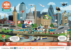
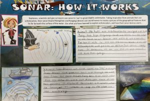 Pupils undertook a study of SONAR technology, beginning with a look at echolocation in animals. They learned all about how bats use sound to ‘see’ their surroundings. Through this, they garnered an understanding of the process of emitting sound waves and analysing their echoes in order to understand both locational and directional data. Pupils then explored the ways in which scientists, technicians and geo surveyors have employed this concept in their SONAR technology. Using the Get Kids into Survey exploration poster resources, they explored a busy offshore scene, where the hydrography technology they had studied was being put to use in a range of scenarios. They learned how boats use SONAR to map underwater features, and in this case, how that technology could be used to unlock the secrets lurking beneath Loch Ness. It became clear that plenty of scans and explorations had taken place on the lake, some claiming to disprove the existence of Nessie through lack of findings; others claiming to have either spotted the creature itself, or found lairs where the monster might easily hide. In 2018, we discovered, scientists embarked on an eDNA analysis of the loch, and found a considerable presence of eel DNA – sparking the idea that an as-yet unidentified species of giant eel might live in Loch Ness. It was beginning to look like geo tech might be the best source of concrete information!
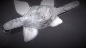 Having looked into the ‘evidence’ behind the mystery of the Loch Ness Monster, we decided to have some fun with the hoaxes! The notorious ‘Surgeon’s Photograph’ from 1934 endured for sixty years before being revealed as a fake; a cardboard and plasticine model attached to a toy submarine. In that spirit, pupils used modelling clay to create the classic shape of the creature, then painted their models a grainy grey. After that, they took their replica monsters to a Reception class water tray and, employing some trick photography on tablet devices, captured images that would give the Surgeon’s Photograph a run for its money!

Please fill out the form below to access our Translation Options Hotsheet:
In today’s Character Spotlight, we discover a little more about one of GKiS’s awesome sponsors “SheMaps”
 Company Name: She Maps
Location: Australia
Why did you get involved in Get Kids into Survey? Dr Karen Joyce, one of our co-founders, is passionate about the spatial industry, and getting more kids to understand the potential of the industry and the technology involved, beyond what they think it is, is important. Get Kids into Survey is also just a really fun brand to be working with.
What do you do? You are all about increasing the diversity in the STEM workforce. We do this by working with schools to run drone programs. This is STEM by stealth, as we weave into our programs a whole lot of information about the spatial industry, as well as providing real world applications, but the students often think they are just having fun flying drones!
How long have you been in the Survey Industry? Karen has been in the spatial industry as a remote sensing scientist for over 20 years.
How did you get into the Industry? When Karen was at Uni she chose her subjects by what would get her into the outdoors the most, and onto the Great Barrier Reef. With a love for the sciences and environmental monitoring in there as well, she was drawn towards remote sensing!
Funny Fact about you – Karen and Paul (our other co-founder) met when they were both serving in the Army. After Karen moved to Wellington in New Zealand, and being too cold for 2 years, they moved to Darwin, Australia in the tropics – from the freezer to the frypan!
Favourite piece of kit and why? Definitely drones! They are just so versatile and have enabled Karen to get highly detailed spatial data of her research sites.
Favourite Survey technique and why? Karen loves being able to set up a drone mapping mission on Heron Island on the Great Barrier Reef, and having her drone fly an autonomous mission, collecting data. It is just so satisfying to be able to work with this technology, to do something I only dreamed of being able to do when I started at Uni.
Your website: www.shemaps.com
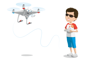
If you have a character; how did you choose and what does he/ she/ thing represent? Mean to you? We have Dronie – She is currently having a children’s book written about her adventures around Australia. Dronie represents all the women who have challenged themselves to overcome adversity and industry stereotypes and succeed in the STEM workforce.