
 How did you get into surveying?
 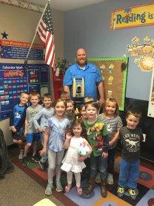 Why do you want to be a GKiS Brand Ambassador?
  If you/your company had a GKiS character, what would it be?
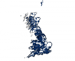 The British Geological Survey (BGS) are an organisation
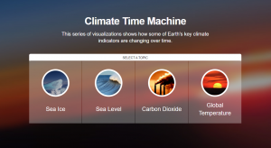
 Do you know what your carbon footprint is? It is interesting to find out and amazing to see what different factors contribute the most to increasing your carbon usage. Although some may put this problem down to the larger companies, it is each of our responsibilities to make little changes and be as kind as we can to our planet. If we all start making little changes to improve, that will equal a whole lot of positives between hundreds, thousands or millions of people. Have a go at this carbon footprint calculator by the charity WWF:
 Why do you want to be a GKiS Brand Ambassador? For the last 5 or 6 years I have been a proponent of introducing elementary, high school, and college students to Land Surveying.
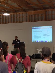
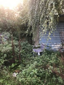 We were each equipped with a clipboard, site map, data collection sheet, bat detector and a torch. When we saw a bat we would jot down the time heard, which frequency we heard them best at, and if seen mark their location/direction on the map. The leader had set up some bat recording devices around us so that she could revisit the data and properly identify the bats through their calls. She does this by listening to the data at the times we recorded hearing a bat. This limits the chances of errors as the bats are identified correctly by a professional.
 For this survey I arrived on site at 18:00 as the nights started to draw in faster as we approach winter. Again there were three of us taking the surveys, however, this time the site included a compound and two large fields with developments nearby. The aim of this survey is to walk around the designated section, to see if we could see/hear any bats along the transect.
 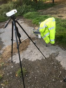 Bat Detector- b
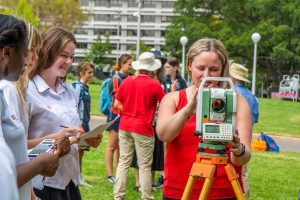
 ‘Surveying Tripods’ are a special tripod built to support surveying instruments, such as theodolites, total stations, levels, prisms or transits
 ‘Disto laser measurers’ are

Please fill out the form below to download our Monopoly Sponsor Info Sheet Download:
 Company Name – Seiler Geospatial.
Location – Midwest United States (we have offices in MO, KS, NE, WI, MI, IN, IL).
Why did you get involved in Get Kids into Survey? We loved the idea of promoting and supporting continuing education. The Seiler family have supported continuing survey education with equipment donations and scholarships to many of the Midwest surveying colleges and universities across the Midwest.
What do you do? Our core strength is supporting the Geospatial Industry by continuously expanding and evolving to promote and educate our customers on new technologies and industry trends. Seiler Instrument is one of the largest Authorized Trimble Distributors in the Midwest and a premier distributor for several other high quality hardware and software products. We are dedicated to our clients’ success by providing the best hardware, support, and software tools that fit their specific workflows, which ensure efficiencies and profitability. Our products include Survey Optical, GNSS, Data Controllers, 3D Scanning, Drones, Mapping GIS, Utility Survey Systems, Field and Office Software and much more. Our family owned business has a complete satisfaction purchase policy and we are committed to our customers’ complete satisfaction.
How long have you been in the Survey Industry? 75 years – this year is our 75th Anniversary!

Tom Seiler, Louise Schaper, Eric P Seiler, Elaine Seiler, Rick Seiler
How did you get into the Industry? Seiler Instrument was founded in 1945 by Eric H and Dora Seiler. Today the family business is headed up by Chairman Eric P. Seiler-2nd generation, President and CEO Rick Seiler, Louise Schaper and Tom Seiler all the third generation. Kurtis Schaper, Eric Seiler III, and Matt Seiler comprise the 4th generation also working at Seiler Instrument. Our founder Eric H. Seiler helped create a company and culture of hard work, excellence in quality, service, reliability and integrity in Optical Instruments.
![]() Did you know that Seiler Instrument/Seiler Geospatial, played an important role in surveying history as one of the original makers of surveying instruments from the United States, St. Louis area? Seiler founded Seiler Instrument Company in a small facility at 922 Pine Street, St. Louis, Missouri 75 years ago. Its primary service was the repair and overhaul of surveying instruments and microscopes. The company continued to grow and was soon manufacturing instruments designed by Eric H. Seiler. Most were Dumpy levels for the construction industry, but also included transits and theodolites.
Did you know that Seiler Instrument/Seiler Geospatial, played an important role in surveying history as one of the original makers of surveying instruments from the United States, St. Louis area? Seiler founded Seiler Instrument Company in a small facility at 922 Pine Street, St. Louis, Missouri 75 years ago. Its primary service was the repair and overhaul of surveying instruments and microscopes. The company continued to grow and was soon manufacturing instruments designed by Eric H. Seiler. Most were Dumpy levels for the construction industry, but also included transits and theodolites.  In 1956, the company outgrew its facility and moved to 1629 Washington Avenue in St. Louis and expanded again in 1968 when they moved to accommodate a complete optical manufacturing environment expansion to Webster Groves, Missouri. Today the family owns a 150,000 square foot facility in Kirkwood Missouri along with six other offices across the Midwest United States. We no longer manufacture surveying instruments, but are one of the largest resellers for Trimble Navigation in the Midwest United States.
Favourite piece of kit and why? The Trimble SX10 and Trimble X7 are the latest survey scanning and 3D modeling products to help surveyors do their job. Scanning and 3D modeling are the future of surveying, More and more people want and need to see additional data, thus with more data you can make better decisions.
Favourite survey technique and why? Surveyors use instruments to lay our property lines, housing and subdivisions and for infrastructure maps, topographic and aerial maps and much more. Surveyors are the ones responsible for maintaining land boundaries and boundaries are the basis of real property and wealth – e.g. where are my property lines and how much property do I own? Just about everything built needs a survey and surveyors are the first ones to be involved in locating and laying out what will be built. They ensure what is built is in the “right place.”
Your website: www.seilergeo.com