 Where did you study?
  Why do you want to be a GKiS Brand Ambassador?
  1- The GeoSquad help to teach kids (and adults) about the types of jobs surveyors do. Help your kids understand what you do for a living!
 Your
Your  Where did you study?
 Follow along as team member
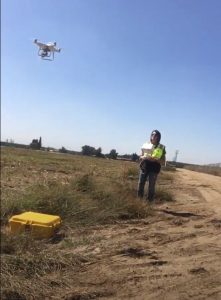
  Firstly, we hammered some markers in the ground and spray painted around them with their numbers. Around the boundary of the site there were 8 points, ensuring that we could see a clear path back and forth to the previous point (so that the equipment could connect, ‘see’ each other as I like to think).
 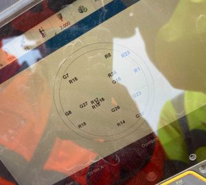 The two first points need to be a ‘known’ location so this requires the GNSS system. The GPS communicates with the satellites (see picture) to get the exact location of our point. With this it calculates the distance and angles between the two known, in order for us to apply this to all the other points on site.
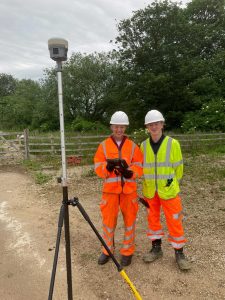 There is a reason that the GPS isn’t used to calculate all the points, but instead the total station and laser scanner come out. This has 3-4mm error range whereas the GPS has plus or minus 30mm accuracy! So better results with total station, which is very useful for everyone on site.
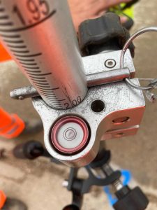 For each point onwards the total station needed to be levelled, this was done firstly using the eye tool. What was cool about the SX10 was there was a camera on the bottom which allowed you to see when the scanner lined up exactly over the point in the ground. This was a little challenging as you then have to level the top part too using 3 twisty rounds (the sighting and the trunnion). Once nearly perfect we measure the height of the scanner from the ground and walk away to the next point.
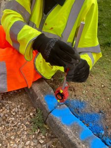 At the following point we align the SX10 to clock onto the prism (picture) at a height of 0.100m. Here the SX10 takes two measurements, turning 180 degrees for the second to reduce error. This method is called traversing (going back and forth taking measurements).
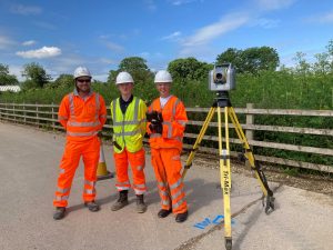
Please fill out the form below to access our Translation Options Hotsheet:
Welcome to our Brand Ambassador Jocelyn Correa, from California USA!
 Where did you study? I did not go to school for Land Surveying, I went to a local community college for Architecture and Sociology
What are the requirements to be a surveyor in your area? In California, it is either a combination of a degree related to land surveying, and/or experience under another Licensed Land surveyor, for a total of 6 years. For example, 4 year degree, plus 2 years experience… or 6 years of experience.
How did you get into surveying? I worked for a local Assessor’s office, originally getting the job just because I knew AutoCAD, but wound up learning the basics of Land Surveying concepts
If you are not a surveyor, what do you do?
How long have you been in the industry? I started as a cadastral mapper in 2004, so a bit over 16 years. I’ve been with a Land Survey/Engineering company for the past nearly 7 years.
Are you part of any associations or organisations you would like us to mention? CLSA (state member and Local chapter secretary), NSPS member, and past ASPRS member
Why do you want to be a GKiS Brand Ambassador? I want to have additional resources to reach out to schools in my area, and assist with promoting our AMAZING profession. I think partnering with GKiS will assist me connect with the kids better, and not have to generate interest-catching material myself
Why is it important for kids to know about surveying and the wider geospatial industry? Surveying is a VITAL profession for the future of the built environment, for future infrastructure and repairing or maintaining existing infrastructure.
What are you going to do as an ambassador for GKiS? As a brand ambassador, I’d like to begin presenting to more schools, and reaching a larger age group. Currently, I have only worked with students in a High School geometry class, and also worked with the DiscoverE Future Cities competition. I think it’s important to also expose younger kids to the Land Surveying profession
What are your hobbies? I love watching my kids participate in their activities: gymnastics, baseball, horseriding, and theatre. As weird as it sounds, I also love organizing, planning, and cleaning.
If you/your company had a GKiS character, what would it be? If my company had a character, I think we’d be a chameleon… we do SO many different services to make the built environment possible. If I was a character, I think I’d be a deer… a bit high-strung, but shy, intuitive, and very aware of my surroundings. If it was a survey specific character, I think I’d be a researcher… I LOVE researching old documents, maps, and the history involved in land surveying
What poster or resource would you like to see next from GKiS? I think stickers would be awesome!