When we think of archaeology, many picture trowels carefully scraping soil away from Roman pottery or explorers in desert tombs. But behind every great discovery is something less obvious yet just as important: surveying.
Surveyors and archaeologists often work hand-in-hand, using modern tools to reveal the secrets of ancient worlds. For parents and kids, this opens up a fascinating way to see how maths, science, and technology connect with history.
Unearthing the Past with the Help of Surveyors!
Archaeology isn’t just about digging—it’s about understanding where to dig and recording what’s found. That’s where surveyors come in.
Surveying in archaeology helps to:
- Map ancient sites before excavation begins.
- Detect hidden structures underground or underwater.
- Reconstruct buildings digitally so we can explore them safely and preserve them for the future.
In short: surveying is the bridge between the past and present, showing us what once stood where we live today【1】.
Tools of the Trade
Surveyors working in archaeology use some of the same tools as in construction, but with a historical twist:
- LiDAR Scanning: Fires laser pulses from drones to detect buried villages or lost temples hidden under forests. Archaeologists recently used LiDAR to map long-forgotten Mayan cities in Central America—revealing entire networks of roads and buildings that had been invisible beneath jungle canopies【2】.
💡 Did You Know?
LiDAR can even see through jungle leaves! That’s how scientists discovered 60,000 hidden Mayan structures in Guatemala in 2018【3】.
- Ground Penetrating Radar (GPR): Works like an underground x-ray to spot walls, mosaics, or even graves without disturbing the soil【4】.
- GNSS Mapping: Uses satellites to pinpoint exactly where dinosaur bones or Roman ruins are found—so nothing is misplaced.
- Photogrammetry: Turns photos into 3D models, perfect for recreating pyramids, castles, or shipwrecks.
Tales of Adventures in the Field
- Roman Britain
Imagine a team scanning the ground around an old fort. A surveyor’s radar shows a mosaic floor hidden underground—like using “superhero vision” to see the past.
- Egyptian Desert
Drones fly over pyramids, creating 3D maps of tomb layouts. This reminds us of the discovery of the Rosetta Stone in 1799, which became the key to unlocking the secrets of Egyptian hieroglyphics【5】. Today, surveying tools play a similar role: helping us “translate” the invisible ground into stories about the past.
💡 Did You Know?
Before the Rosetta Stone, nobody alive could read ancient Egyptian hieroglyphs. Thanks to it, archaeologists unlocked thousands of years of history!
- Sunken Shipwrecks
Surveyors send robots underwater to scan wrecks. Augmented reality then shows us what the ships looked like before they sank—like a history video game. Underwater cultural heritage is especially fragile, which is why UNESCO helps document shipwrecks and submerged ruins using surveying methods【6】.
- Dinosaur Digs
GNSS and tags keep track of each bone. Just like at Olduvai Gorge in Tanzania—where archaeologists discovered some of the earliest tools and human fossils, nearly 2 million years old【5】—surveying makes sure every find is recorded with precision.
💡 Did You Know?
At Olduvai Gorge, archaeologists found stone tools and human fossils showing that our ancestors used technology nearly 2 million years ago!
How Parents Can Spark Curiosity at Home
If you want to bring this world to life for your kids:
- Go on a “Survey Walk” – Give them a notebook and ask them to map your garden, park, or street.
- Spot Landmarks – Look at old buildings or ruins nearby and talk about how surveyors help preserve them.
- Use Free Apps – Try AR (Augmented Reality) or mapping apps to show them how the digital world can reveal hidden layers of the real one.
- Explore Resources – Posters, colouring sheets, and Q&A guides from Get Kids into Survey are brilliant starting points.
How Companies Can Help Inspire the Next Generation
This month Get Kids into Survey have launched an exciting campaign for the Autumn Archaeological Surveys Poster. This poster aims to teach kids aged 8-12 years old about all of the ways surveyors help to uncover our history and heritage!
Does your company get involved in archaeological tasks?
Do you want to be represented on the poster with your company logo and bespoke cartoon character?
Please take a look at our information booklet which can be downloaded through this page.
The Takeaway…
Surveying isn’t just about construction or boundaries—it’s also a key to unlocking history. By blending technology with archaeology, surveyors help us rediscover lost worlds and inspire the next generation to look beneath the surface, literally and figuratively.
So next time your child asks, “How do we know what’s underground?”, you’ll know the answer: surveyors help us see the invisible past.
References
- Encyclopedia Britannica – Archaeology
- National Geographic – Maya LiDAR discovery
- BBC – LiDAR reveals 60,000 Maya structures
- Archaeological Institute of America – Archaeology 101
- Complete University Guide – Top Ten Archaeological Discoveries
- UNESCO – Underwater Archaeological Mission

 How did you get into surveying? Growing up, I wanted to be a pediatrician because I love babies. My story had a little twist during my application to the university. In Ghana, you are to make 4 choices for programmes you want to study at a particular university. My uncle, who was my acting dad since I lost my dad at the age of 11, recommended Geomatic Engineering as part of my choices. I was given an offer to study Geomatic Engineering amongst the other choices. I studied BSc. Geomatic Engineering at Kwame Nkrumah University of Science and Technology in Ghana. And I can truly say that, though it was a difficult decision to make at that time, I have no regrets accepting that offer. The journey has been full of discovery, even of myself, and I am happy about that.
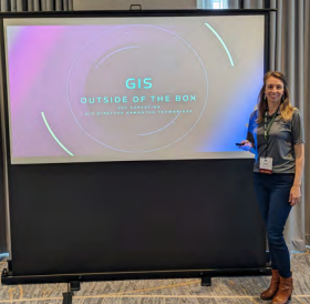 How did you get into surveying? I started out working as a student for USGS and their program for Coastal Restoration in Louisiana. I job was to collect data and create the maps to monitor coastal erosion. This inspired me and I began my journey in GIS Geographic Information Systems and how it can assist in Surveying. I work hand in hand with Surveyors all over the US in elevating their survey grade data and promoting it through GIS displays and monitoring maps.
 How did you get into the Geospatial industry? My partner is a PLS in Oregon and is a Geomatics Instructor at Oregon State University. I took my current job because I could see there is a need to help grow the surveying workforce. My oldest son has also spent a summer interning as a survey tech locally so I like to encourage teenagers to pursue similar opportunities in high school.
 How did you get into the Geospatial industry? Loved the Mapping part of being a Geologist & converted with a Masters in Land Surveying from UCL. Joined as a Senior Surveyor, became a Partner, Director & Business Owner over a 30-year career.
 Why are you volunteering as a Brand Ambassador? I want to be a GKiS Brand Ambassador to help young people explore geospatial careers and address the shortage of geospatial professionals in the UK and beyond. By spreading awareness and offering educational opportunities, I aim to inspire and support the next generation in this field.
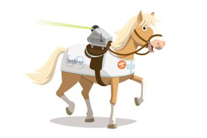 Well, NEIGH-bor, surveying is a super cool job! You get to explore new places, work outdoors, and use awesome Tech & gadgets like LiDAR, drones and GPS. I want kids, just like you, to see how fun it is to measure the world! Every hill, tree, and sidewalk tells a story — and surveyors get to be the storytellers.
 How did you get into the geospatial industry? I met my survey instructor, Dave Langhoff, at an open house at Milwaukee Area Tech College in 2014 while looking for career options. Needless to say, he sold me on the profession and I’ve been involved ever since.