
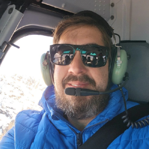
Ambassador Spotlight ‘Emanuel Rugaro’

Introducing our latest Brand Ambassador Emanuel Nyasha Rugaro from Harare in Zimbabwe:

Where did you study? Midlands State University, Zimbabwe 

What are the requirements to be a surveyor in your area? Qualification from a recognised university/ college

How did you get into surveying? In 2012, I was doing my advanced-level education. We were invited to attend a career guidance seminar, and there were many people representing different professions. I met a Surveyor named Tinashe, and he took me on a tour, introducing me to professionals in the survey profession and showing me different equipment used by surveyors. He explained to me how this equipment is used and shared stories about how this profession is filled with adventure. He made it sound like all the surveyors have fun when working. It was at this moment that I decided I also wanted to be in this profession. 

How long have you been in the industry? I have 5 years experience in numerous projects spanning engineering surveys, cadastral/demarcation surveys, aerial and utility mapping surveys, road surveys, feature/topographical surveys, and mechanical, electrical, and plumbing (MEP) setting out surveys.This has also helped me sharpen my skillset around survey-related software and equipment.

Are you part of any associations or organisations you would like us to mention? Survey Institute of Zimbabwe 

Zimbabwe Institute of Geomatics 

Why do you want to be a GKiS Brand Ambassador? I did my high school education from 2007 to 2012. In 2012, I was doing my advanced-level education. We were invited to attend a career guidance seminar, and there were many people representing different professions. I met an ambassador named Tinashe, and he took me on a tour, introducing me to professionals in the survey profession and showing me different equipment used by surveyors. He explained to me how this equipment is used and shared stories about how this profession is filled with adventure. He made it sound like all the surveyors have fun when working. It was at this moment that I decided I also wanted to be in this profession. I’ll never forget that kindness, and I want to pass it on to the young kids. Being a GKiS brand ambassador will give me the chance to encourage the young about our great profession and help them get connected to activities and friends. I’m naturally outgoing, and currently I’m vice president of the Zimbabwe Institute of Geomatics Youth Network, the youth network of a professional board representing the surveying and geomatics professionals in Zimbabwe. So I feel like I’m prepared to speak confidently to others about our profession as kids’ ambassadors. As an ambassador, I want to help GKiS bring awareness about the survey profession to the communities within my reach. 

Why is it important for kids to know about surveying and the wider geospatial industry? Accurate land survey data is essential for making informed decisions about land use, property valuation, and infrastructure development. If kids know more about this profession, it will be easy for the surveyors there today to pass the button on to the next generation. Also, in most countries, there is a shortage of surveyors, and enlightening more of the children will help curb this shortage in the future.

What are you going to do as an ambassador for GKiS? As an ambassador, I want to help GKiS bring awareness about the survey profession to the communities within my reach.

What are your hobbies?

Camping 

Hiking

Boat cruising 

Fishing

If you/your company had a GKiS character, what would it be?

Geospatial kids

What resource would you like to see next from GKiS? Geospatial Magazines, tshirts, handbooks 

Ambassador Spotlight ‘Aaron Michalenko’

Introducing our latest Brand Ambassador Aaron Michalenko from Phoenix, Arizona, USA:

Where did you study? I pursued my studies at Glendale Community College (A.A.S. in CAD Technology) and also at Phoenix College (A.A.S. in Land Surveying). During my time at these two colleges, I was deeply fascinated by land measurement and decided to specialize in cadastral surveying.

What are the requirements to be a surveyor in your area? In some areas, to become a licensed cadastral surveyor, you typically need a bachelor’s degree in surveying or a closely related field. Then, you must complete several years of work experience under a licensed surveyor and pass a licensing exam.  Arizona does not require the bachelor’s degree, but did accept my college years as a comparable 4 years of schooling, which was really cool of them.

How did you get into surveying? While at Glendale Community College, I came across a group of students working on a cadastral project. Back then, I thought I wanted to be an Architect.  The student’s work intrigued me, and it also had elements of Architecture in the courses, so I switched my focus to surveying. I’ve always had a keen interest in understanding and organizing data, and surveying provided a perfect blend of data, technology, and outdoor work.

How long have you been in the industry? I’ve been in the surveying industry for over 20 years now.

Are you part of any associations or organisations you would like us to mention? Yes, I am a proud member of the American Congress on Surveying and Mapping (ACSM) and the National Society of Professional Surveyors (NSPS).

Why do you want to be a GKiS Brand Ambassador? I believe in the potential of the younger generation. Being a GKiS Brand Ambassador would allow me to inspire them, showcasing how the geospatial industry can impact the world. Given my background and passion, I believe I can make a significant contribution.

Why is it important for kids to know about surveying and the wider geospatial industry? Understanding our world begins with understanding its dimensions. Surveying and geospatial sciences help us understand our environment, plan our cities, and protect our natural resources. It’s essential for kids to know about this, as they’ll be the ones to shape our future landscapes.

What are you going to do as an ambassador for GKiS? I’ll leverage my platform to raise awareness about surveying. By hosting workshops, collaborating with schools, and using technology, I aim to make geospatial sciences more accessible to the younger generation.

What are your hobbies? I love learning new things.  Recently, I’ve started to teach myself how to create video games.  

If you/your company had a GKiS character, what would it be?

Here are 10 options I like:

RiseRyder: A phoenix rising from a cityscape, embodying transformation and rebirth. Its wings showcase urban graffiti art, while it holds a digital GPS in its talons.

MetroMaverick: A cool, urban fox wearing sneakers and a snapback. This character is all about navigating both the challenges of the city streets and geospatial sciences.

RebelRadar: A street-savvy hawk with tattoos of coordinates on its wings, symbolizing a sharp vision that overcomes adversity.

NeonNomad: A chameleon that changes its colors to neon street art, holding a holographic map. Represents adaptability and modern tech vibes.

GraffitiGeo: A lion prowling the urban jungle, its mane adorned with colorful street art and it holds a laser scanner, representing strength and precision.

TechTideTurner: A dolphin equipped with sonar tech and VR goggles, symbolizing the leap from troubled waters to mastering modern geospatial tools.

PulsePioneer: A wolf with a digital heartbeat line running through its fur, holding a drone, representing the pulse of modern city life and tech innovation.

StreetSavvySatellite: A futuristic robot with traces of paint splatters, symbolizing the blend of street culture and high-tech geospatial advancements.

EchoElite: A panther with sound waves echoing from its paws, symbolizing the journey from unheard cries to making a significant mark in the world, all while holding a modern rangefinder.

UrbanUprising: A deer with antlers shaped like city skyscrapers, holding an augmented reality tablet, symbolizing growth, and the rise from challenges.

What resource would you like to see next from GKiS? I’d love to see an interactive app or platform where kids can virtually experience the world of surveying, perhaps with augmented reality to bring the concepts to life.

Anything else you want to add that you think our audience (surveyors, teachers, parents) would be interested in? Surveying isn’t just about measuring land; it’s about understanding our world and ensuring that we leave a sustainable environment for future generations. Encourage the young minds around you to explore, question, and delve into the geospatial realm. The future of our world depends on it.

Ambassador Spotlight ‘Eddie Fossler’

Introducing our latest Brand Ambassador Eddie Fossler from Omaha, Nebraska, USA:

Where did you study? – I graduated from ITT Technical Institute with my Associates Degree in Computer Aided Drafting and 3D Animation

What are the requirements to be a surveyor in your area? – To Survey you need to be willing to work under other Surveyors, and be open to learning and challenging yourself. In order to become a Licensed Professional Surveyor in Nebraska, you need sufficient experience in the Surveying Profession (approximately five years), a recommendation from another Licensed Professional Surveyor, and the ability to pass the Professional Surveyor In Training test (PSIT) and then the Professional Licensed Surveyor test (PLS).

How did you get into surveying? – I got into Surveying by pure curiosity and willingness to try new things. After I had been in the profession for a few years and had been exposed to a variety of different types of Surveys, I got very excited about how I could learn and grow!

If you are not a surveyor, what do you do? – I draft and create every type of survey that is required from our projects. While not a Licensed Professional Surveyor, I do perform all of the duties and responsibilities of a PLS, the only difference is that I don’t sign surveys.

How long have you been in the industry? – 27 years

Why do you want to be a GKiS Brand Ambassador? –Surveying has opened up my world in so many great ways, and my life is better for having had “dove in” and taken a chance on learning it. There is so much growing and changing in this profession, that the idea of being able to help young people become aware of and interested in surveying and the opportunities it creates is exciting and meaningful to me.

Why is it important for kids to know about surveying and the wider geospatial industry? – Because the disparity between how much the public knows about surveying and geospatial, contrasted to how important these professions are to our modern society is frankly shocking. Even if only to help create awareness four the future of our world, GKiS is a massively important movement.

What are you going to do as an ambassador for GKiS? – I’m going to demystify some of the aspects of surveying and share my experiences and expertise in a way that’s relatable and fun. Tie surveying to our everyday lives and show kids how boundary, topography, and layout help create our modern society and create some of the fun things that we all enjoy! Whether it’s public presentations, or hands on demonstrations with local STEM groups, or even community organizations, I’m going to utilize my ambassadorship for GKiS as a great way to get those conversations started.

What are your hobbies? – I love creating podcasts, nature walks, rollerblading/skateboarding, singing, reading, watching movies and playing video games.

If you/your company had a GKiS character, what would it be? – The Olsson Otter! We do quite a few waterway surveys and we’re fun and social!

What resource would you like to see next from GKiS? – Perhaps an app that allows you to upload and share notable and interesting projects to share in demos and presentations?

Anything else you want to add that you think our audience (surveyors, teachers, parents) would be interested in? – I think and animated short featuring the characters from GKiS would be amazing!!

Ambassador Spotlight ‘Sunday Ishola’

Welcoming our latest Brand Ambassador Sunday Ishola from Lagos, Nigeria:

Where did you study? I studied Surveying & Geoinformatics at the  University of Lagos, Nigeria

What are the requirements to be a surveyor in your area? A bachelors degree in Surveying & Geoinformatics with at least 2 years of pupilage in a registered survey company under the supervision of a registered surveyor with the Nigerian Institution of Surveyors.

How did you get into surveying? Some group of surveyors came to my high school and that birthed my interest in surveying

How long have you been in the industry? About 7 years

Are you part of any associations or organisations you would like us to mention? Young Surveyors Network, Lagos chapter.

Why do you want to be a GKiS Brand Ambassador? I have benefitted from this kind of initiative in the past and I feel I owe the next generation a similar duty

Why is it important for kids to know about surveying and the wider geospatial industry? This is crucial because surveying is the bedrock of all developments and to secure the future of this profession, kids have to be aware

What are you going to do as an ambassador for GKiS?  I will organize and plan outreaches to elementary and high schools to spread awareness of the profession and what this brand represents. I will let them know about various opportunities in the geospatial industry and how it will grow in the future.

What are your hobbies? Making music & travelling

What resource would you like to see next from GKiS?  games


Brand Ambassador ‘Arnab Laha’

Welcoming our latest Brand Ambassador Arnab Laha from Uttar Pradesh, India!

If you are not a surveyor, what do you do? I am a doctoral student at the Indian Institute of Technology Kanpur, India, specializing in Space Geodesy, focusing on Earth Orientation Parameters (EOP) analysis using Very Long Baseline Interferometry (VLBI). I’m also actively involved in assisting students with survey instruments and teaching subjects like surveying, remote sensing, and GNSS. Please have a look at my webpage for updated information: https://home.iitk.ac.in/~alaha/
How long have you been in the industry? I am a Civil Engineer with a background in surveying from my bachelor’s studies. I pursued remote sensing during my master’s degree and am currently engaged in advanced surveying techniques for my PhD. I bring five years of practical experience in the surveying field to my work.
Are you part of any associations or organisations you would like us to mention? I have been associated with the National Centre for Geodesy at the Indian Institute of Technology Kanpur.
 
Why do you want to be a GKiS Brand Ambassador? As I explored the GKiS website, I noticed their commitment to fostering tech-savvy and innovative students in surveying. My objective is to simplify complex technical terms, making it easier for students to grasp both innovative survey techniques and traditional geodesy methods. I am committed to closing the knowledge gap in geodesy and surveying, recognizing their significance in both modern and developing societies.
Why is it important for kids to know about surveying and the wider geospatial industry? It is important for kids to know about surveying and the wider geospatial industry as;
  1. To be aware of new technologies and inventions happening worldwide in this field.
  2. To understand about this field and make a career in surveying and geodesy.
  3. To know about real-world applications such as reading maps, finding positions, calculating distances and angles, and positioning devices.
What are you going to do as an ambassador for GKiS? As an ambassador for GKiS, if possible, I want to  go for;
  1. Organizing online seminars and presentations about surveying and geospatial sciences.
  2. Organize live demonstrations of surveying equipment and technology, allowing children to see how surveying works.
  3. Establish mentorship programs where experienced geodesists or surveyors can guide and inspire young individuals interested in this field.
What are your hobbies? I love to explore various places and click photographs, giving me many memories and timeless happiness. I also understand new innovations and inventions happening worldwide during my free time.
What resource would you like to see next from GKiS? The resources that I would like to see next from GKiS are;
  1. A well-defined curriculum is designed for students in schools and diploma colleges.
  2. Puzzles and games related to surveying.
  3. More exciting views on websites like those related to space, earth’s crust, etc.
  4. Telling about new surveying techniques.
Anything else you want to add that you think our audience (surveyors, teachers, parents) would be interested in? Nowadays, everyone wants to know about the current events happening around the world related to their respective fields. The contribution made by the surveying community as a whole should be demonstrated on the website as a blog to learn about various research going on globally.

Character Spotlight ‘UTSS’

Introducing UTSS! Our latest sponsor of the Intergalactic Power Problems Homework Project which you can find here.

  1.   Company Name–  Utility & Transmission Survey Solutions Ltd
  2.   Location– Midlands Based but work through the whole of the UK
  3.   Why is it important for your company to help Get Kids into Survey? There is a massive skill shortage within all aspects of our industry and getting Kids involved at an early age will hopefully bring a few on into survey in later life.
  4.   What do you do? We initially started within the energy sector looking at new build, rebuild and diversions of overhead powerlines providing the route corridor topographical detail, as well as designs for them. Following COVID we have diversified and included many survey types, from underground utility surveys, topo surveys, 3D laser scanning, UAV based surveys as well as swept route analysis surveys.
  5.   How long have you been in the survey industry? As UTSS ltd I’m in my 10th year
  6.   How did you end up getting into the geospatial industry? I was asked to be involved by a representative of one of my former employers due to my overhead power line knowledge and experience. So I set up the company and the rest is history as they say.
  7.   State a funny fact about you… apparently my skipping prowess is funny, but I’m not sure!
  8.   Favourite piece of kit and why? I always enjoy getting out the big UAV’s to undertake LiDAR based surveys, may be as I’m a big kid at heart.
  9.   Favourite Survey technique and why? Hmm not sure I have a favourite as they all have there place based upon what is being done and required.
  10. Your website
  11. How did you choose the character and what does he/she/it represent? Mean to you? What’s his/her name? – The character is based on myself, Richard and my red working cocker, Amber, representing that the survey industry is an enjoyable place to be.

Ambassador Spotlight ‘Priyanka Miller’

Welcoming our new Brand Ambassador Priyanka Miller from Phoenix, Arizona, USA:

If you are not a surveyor, what do you do? How long have you been in the industry? – I am Geographic Information Systems (GISP) professional with 20 years of experience. 

Are you part of any associations or organizations you would like us to mention? I am a Geographic Information Systems Professional (GISP) and a FAA Part 107 Licensed Pilot (UAS/ Drone Pilot).

Why do you want to be a GKiS Brand Ambassador? I teach an elective on maps and drones to middle and high students, I love introducing students and fellow teachers to geospatial technologies and aerial mapping, so GKis Brand Ambassador is a great fit!

Why is it important for kids to know about surveying and the wider geospatial industry? Geographic Information systems (GIS) is a powerful tool that promotes critical thinking and problem solving. Introducing students to visualizing data via interactive maps and offering a different perspective of viewing their world from a drone/ aerial images leads to exploration and curiosity. Applying drone data collection and data analysis techniques are all essential skills in order to solve real world problems now and in the future.

What are you going to do as an ambassador for GKiS? Share my passion and continue introducing students, teachers and parents to geospatial technologies and drone mapping at a wider scale.

 What are your hobbies? Travelling, Reading and exploring new places and cultures with my kids and husband

 If you/your company had a GKiS character, what would it be? A diverse and a dynamic team equipped with maps and drones 😊

What resource would you like to see next from GKiS? More teaching material and resources for middle and high school students

Anything else you want to add that you think our audience (surveyors, teachers, parents) would be interested in? I started my own consulting firm- Mil Geospatial and recently celebrated 10 years in business! 

Greenhatch at Becket Primary School

Overview of the project – Bridging the gap between education and future careers at Primary Level 

This article has been written by Becket Primary School in the UK! Thank you for allowing us to share your experiences with our sponsor The Greenhatch Group:

“At Becket we believe that our children should have every opportunity to see what’s ‘out there’ to promote positive possibilities for the future. We also want to enhance our curriculum to highlight the relevance of their learning. To show children that learning matters and can be applied in the outside world. We want to foster that intrinsic motivation to learn, for the children to want to better themselves and know there is a purpose to their learning. 

These “outside-in” experiences are priceless. In one morning session, we covered a range of skills that are needed for the future work place. The ‘hands on’ activities of using and respecting expensive equipment to measure our field not only exposed the children to a career in surveying but how the maths skills they learn in school are applied in ‘real life’ jobs. 

After talking with Lee Mousley and Sam Lewis from the Greenhatch Group we discovered that we had similar aims for the children in our community. Greenhatch are a part of a project which reaches out to schools to ‘get kids in to survey’.

I was really impressed with how Mr Lewis spoke about The Greenhatch Group. He reflected that as a company they wanted to ‘do better’ for the communities around them and that the company is not all about profiteering.  It was a chance for them to give back to the community as well as a chance to promote their profession. In terms of The Greenhatch Group company’s gains – there isn’t really a lot in it for them as business, but I think I am safe to say how Mr Lewis felt when he left, he gained a lot from the experience of working with the children”.

Structure of the morning visit. 

Mr Lewis introduced himself to the class and spoke about what surveying is and how it related to the children’s lives – building of houses, schools etc. This was particularly of interest to the children as we are expecting our new school to be built on the field in the near future. Mr Lewis spoke about the collaboration of surveyors, architects and builders to bring projects like ours to fruition. The children were taken out onto the field to start their first activity – measuring using a total station. 

Activity 1 – field work

To recap millimetres, centimetre and metres – Children were shown a metre stick and asked questions to check understanding with regards to units of measure. They were then asked to estimate the length of the field. We, of course, had some rather interesting answers! Then the children were asked to run across the field counting one stride as a metre and then come back and have a think about their original answer. The children quickly changed their minds and made more informed estimations. 

The children then each had a go at using the total station to measure the field accurately. They dressed up in the appropriate safety clothing (hard hats at the ready!) and worked in pairs to use the total station. They were amazed that the machine locked on to and followed the prism around the field giving different measurements. Each time they were estimating and using their mathematical understanding of measurement to make sensible estimates. 

Activity 2 – heading back to the office

Mr Lewis had prepared a booklet of activities for the children to complete. Each page had a mathematical objective. 

  • Spotting shapes in the London skyline- exploring 2D and 3D shape
  • Spotting how many triangles there were in an image and discussing how the triangle is the strongest shape. Vocabulary like ‘structure’ ‘stability’ and ‘strength’ were used. 
  • pastedGraphic.png pastedGraphic_1.png
  • Completing a drawing of a house on graph paper – exploring symmtery, shape and accuracy
  • A crossword of all the vocabulary that was used over the session – total station-scanner-disto-prism-pogo- tripod
  • Measuring a footprint of a house accurately – exploring accurate measuring in a different way, ruler work and converting mm to cm etc.. 

The children were each given a Greenhatch ruler which they were thrilled about! They were given the rest of the booklet to take home which had some spot the difference activities, word searches and colouring sheets. 

Mr Lewis spoke to the children with ease and it was clear that they were really interested and engaged in what he was saying. Having two female trainees with Mr Lewis also provided our girls with excellent role models.  Mr Lewis also spoke about lifting aspirations for females in a male dominated work place. This led to a discussion the following day with the class about are there any jobs that are just for men/women? 

It was a very successful visit and when Mr Lewis asked what the children wanted to do when they grow up, the usual answer of ‘Youtuber’ was not to be heard! I can say with confidence that aspirations were lifted! 


Great to hear of a positive outcome from outreach! Email us if you’ve a story you’d like featured on get Kids into Survey… Or have a look at our Brand Ambassador network who all volunteer to help in schools as above.