Character Spotlight ‘EveryPoint’

Introducing our latest sponsor EveryPoint! Check out their Homework Project here 

Company Name –  EveryPoint

Location –  Redmond, WA, USA

Why is it important for your company to help Get Kids into Survey?
We have been working in the geospatial industry for a long time and have seen the profession age without a lot of young people entering the industry. Working with survey and geospatial tools is fun and exciting! We believe kids need to be engaged with surveying concepts at an early age to know that surveying is an option for them. Also, the next generation will be using mixed reality tools which are built on geospatial information. Opportunities to grow in this industry have never been better!

What do you do? Our company, EveryPoint, makes software tools that uses photos of real things like trucks, trains, and piles of stuff and turns them into a digital version. Our tools help businesses by answering important questions like: “Is my train broken?” or “Has this big box been in my storage room for too long?” By getting answers to these questions, companies can work better and smarter.

How long have you been in the survey industry? We have been building tools for surveyors and geospatial professionals since 2011.

How did you end up getting into the geospatial industry? Our investors roots were in the geospatial industry and we saw an untapped potential to provide toolsets for non-geospatial companies. We were frustrated with complicated tools that only highly trained surveyors could use. For example, why couldn’t a dump truck driver scan a pile of rock to find out volume? We decided to change how businesses work by providing tools that non-geospatial professionals could use to solve business problems.
  

State a funny fact about you… Our company is almost entirely former musicians!

Favourite piece of kit and why? An iPhone! It may sound like a silly answer for surveying, however, it has a powerful combination of being a high resolution camera, computer, and internet communicator. We are able to deploy solutions to every person’s pocket within a company, making everyone a mini-surveyor.

Favourite Survey technique and why? Photogrammetry! Our roots have always been in image based solutions and we see a lot of potential for photogrammetry and a LiDAR data fusion. Taking the best of both worlds, we can make highly detailed digital twins.

Your website

How did you choose the character and what does he/she/it represent? Mean to you? What’s his/her name? We chose our team member Melissa Webster to be our character. She is a great role model for girls who want to work in technology. She is super smart AND a former collegiate softball athlete. We hope kids can relate to her and realise they too can work in this industry one day.


Character Spotlight ’90 Degree’

Introducing our sponsors 90 Degree!

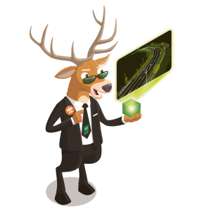
Company Name – 90 DEGREE

Location Romania, Transylvania, Brasov

Why is it important for your company to help Get Kids into Survey? The geospatial industry is growing rapidly and is expected to continue to do so in the coming years. By introducing kids to this field early on, they may be inspired to pursue a career in it and take advantage of the many job opportunities available.

We witnessed a lack of technicians in the sector in most fields, and I believe that as time goes on, the globe would suffer greatly as a result of this lack of knowledge. Personally, I believe that a company like this should exist to introduce every sector of technology into schools sooner, because they can blend the fun side of each profession with the technical part. In this approach, even children who may lack parental support and guidance will have access to a wide range of opportunities.

Overall, every organisation, including ourselves, will have enough manpower to keep the survey technology going.

What do you do? 90 DEGREE specialises in creating engaging point cloud/CAD/3D BIM fly-through animations. These types of visualisations are highly effective marketing tools for companies that offer 3D scanning services, as they allow potential clients to see the results of the scanning process in a clear and engaging way. In short, our company helps other businesses showcase their 3D scanning services using dynamic and interactive visualisations.

How long have you been in the survey industry? We have been in the industry for 10+ years (in surveying), processing data, scanning, filming the scanning process, but for the last 2 years we focused only on fly-through animations.

How did you end up getting into the geospatial industry? I did not participate in any surveying studies for the same reasons stated above: a lack of guidance in both family and school (thus, again, with good guidance, perhaps a kid somewhere will have this opportunity). I had no idea what a point cloud was until a few years ago, but once I knew what it was, I found the concept fascinating. So, in this way I was able to merge my photographic love with the amazingness of scanning.

While my initial path was as a videographer for a scanning company, something more geared towards the artistic aspects of these fields, 3D scanning, point clouds and deliverables, likely sparked an interest in my path.

As a video editor in the geospatial industry, I have a unique opportunity to use my creative skills to help visualise complex data sets and communicate important information to others.

State a funny fact about you: If you did not know: stags are good swimmers, capable of reaching great speeds in water. They will occasionally cross lakes and rivers in search of food on the other side. These animals are far more powerful and adaptable than you may have anticipated.

So, fun fact: our cartoon character can swim, but I can’t. Well, in Transylvania, we are widely known for other things, not for swimming, if you know what I mean.

Favourite piece of kit and why? As members of this industry profile, we are accustomed to working with a wide range of systems and the many types of point clouds that can come from them. We are not in a position to choose between platforms because they all have something unique to offer and may exhibit various types of projects.

In our opinion, each organization should have the ability to promote their services based on their budget and the market services that they offer. And now we’ve arrived on stage

Favourite Survey technique and why? The most popular survey technique is, of course, 3D scanning, because the major workflow that we use includes cad drawings, 3D building models, and, of course, point clouds.

As previously said, 3D scanning techniques feed our work routines, thus it takes first position.

Your website

How did you choose the character and what does he/she/it represent? Mean to you? What’s his/her name? Elmer the stag has an exceptionally broad geographic distribution, and cultures all around the world have attributed this animal metaphorical importance. Because stags shed their antlers in the autumn and regenerate them in the spring, they are signs of the changing seasons and heralds of fresh life. So we can say that the stag is a symbol of rebirth.

We had a rough start moving forward, and we started from virtually zero after opting to go it alone, so we can say that, like the antlers, we started growing anew. We can only pray that each autumn they will fall and that each spring they will begin to sprout again!


Character Spotlight ‘Infinity Land Surveying’

It’s Infinity Land Surveying LLC Character spotlight!

  1.   Company Name Infinity Land Surveying, LLC
  2.   Location – We are based in Phoenix, AZ but we are licensed in Arizona and New Mexico with plans on Nevada and Colorado in the near future.
  3.   Why is it important for your company to help Get Kids into Survey? Having 3 kids of my own, I want them to have a successful career and love what they do. A career in Surveying provides just that, and there is so much opportunity for the next generation. Our biggest obstacle is that most kids do not know what Surveying is. If they did, we would not need to recruit because once they saw how rewarding this career is, they would be lined up at the door with applications in hand…lol.  
  4.   What do you do? I run the day-to-day operations at Infinity Land Surveying.  This includes talking with clients to understand their needs, preparing proposals, drafting existing maps\plats, calculating coordinates, upload\download data collectors, performing fieldwork, drafting the field work, and creating different types of Survey drawings (Boundary, Topographic, As-Builts). Once these maps and documents have their final drafts, they are then and recorded with the County. 
  5.   How long have you been in the survey industry? I started going to school for a Land Surveying Engineering in 1999 and graduated in 2003 from New Mexico State University.  I then went to work in the private land development industry for 8 years, then went into the public sector working for the State Power Company for 6 years before starting my own company.  All in all I’ve been in this industry 24 years….and counting 😊
  6.   How did you end up getting into the geospatial industry?  I took a geology class when I was at community college and one of our labs was mapping a prehistoric formation.  We woke up early and drove way out into the country.  Once there, we loaded up our back packs with everything we needed for the day and started hiking out in to the unknown.  Being that it was a community college class, it was small and we were able to have great conversations with our professors.  My geology professor could tell I was in hog heaven running around the hills with a backpack and a camera strapped to me.  On the way back to the truck he asked me about what I was going to major in once I transferred to the University.  I really didn’t know so I said “Well this was fun, maybe I’ll study Geology”. He just shook his head and said “Why in the world would you want to go and do that?”  I was kind of shocked that he said..lol, but I responded that what we did today was so fun and I’d love to get paid to go off-roading and hiking 😊  He smiled and told me about the Surveying Engineering Program at New Mexico State University.  My next trip to NMSU I made an appointment to meet with the Dept. head.  His name was Dr. Reilly and he welcomed me with open arms, took me to lunch, and then showed me the amount of jobs and the salaries that Professional Land Surveryors were making and the rest is History!!
  7.   State a funny fact about you…I was named after my Great Great Grandfather (William Masi) who was a Frontier Land Surveyor during the 1880’s.  He had a mail order bride because there were very few women on the frontier back then. They had 3 daughters together, but he was the last of his family to carry the “Masi” name and being that he had 3 daughters, he would not be able to carry on the Masi last name, so he decided on a rule that all of his daughters’ sons should have the middle name of “Masi”.  Well my Grandfather is William Masi Wing, my father is Daniel Masi Wing, I’m William Masi Wing, and my son is Tanner Masi Wing. The funny part about it, is that I never know anything about this until my 3rd year of going to school for Surveying. 😊 My dads cousin went on a geneology trip when he retired and found all of this information.  He even found William Masi’s old pocket compass and gave it to me. One day I plan on going up the Cheyenne, WY and researching some of the Surveys he completed and maybe even retracing them.
  8.   Favourite piece of kit and why? I love my GNSS receivers because I started out turning angles with conventional equipment (total station) on a 2–3-person crew and it would take 3 days to break down a mile section.  GPS\GNSS was very new at that time and a lot of the older Surveyors didn’t trust it and wouldn’t use it.  This was a great opportunity to learn all the ins and outs of GPS\GNSS so I could convince the others, that it was a great tool. Once I showed them that we could break down a mile section in 4 hours, they became believers..lol.
  9.   Favourite Survey technique and why? Boundary Surveying, because it’s basically like a big treasure hunt.  First, you have to research the history and that can be very interesting. Then you have to use clues from the research to calculate search coordinates.  Then you get to go out and hunt down those coordinates by car, foot, atv, etc. Just getting to some of these places can be an all-day adventure, but once you get there the real work starts. Using metal detectors and 100-year-old field notes, we comb the desert looking for original monuments.  It is a very special feeling when you find a monument that is over 100 years old and your holding the notes from the person who set it with their own hands and sweat.  
  10. Your website
  11. How did you choose the character and what does he/she/it represent? Mean to you? What’s his/her name? Our character is based on a Buzz Lightyear-ish Surveyor and his trusty sidekick “Norma” the surveying rescue cow 😊 We found her one night while finishing up a boundary survey in the deserts of AZ.  She was lost, freezing, and covered in cactus needles.  As I started the truck to leave the site, she came running up out of the ditch and directly under my truck.  My son thought she was a dog so he jumped out to help.  His eyes were as wide as a cucumber slice when he said “Dad, I think it’s a baby cow!”   I jumped out of the truck and pulled her out from under the truck where she was trying to get warm, and got all the cactus needles out of her.  We weren’t sure what to do, but it was snowing and the coyotes were already howling as it was getting dark. I knew she’d be a goner if we left her, so we put her in the camper shell and took her home.  Now fast forward 2 years and she has here own corral, shade, lights, toys, and all the alfalfa she can eat 😊


Ambassador Spotlight ‘Alexandru-Dorin Paun’

Introducing our latest Brand Ambassador, Alexandru-Dorin Paun from Tulcea, Romania:

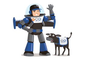
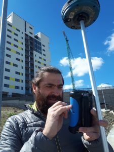
Where did you study? I studied at the Technical University of Construction Bucharest, The Faculty of Geodesy.

What are the requirements to be a surveyor in your area? Well, that depends. To be authorized as a surveyor you have to obtain from The National Agency for Cadaster and Land Registration an authorization certificate, a document that proves your technical competence and your knowledge about the law in this domain. These authorizations are split in 5 different categories, A, B, C, D or E, each one allowing you to do different kind of specialized works. For example, I obtained the D category in 2017, (which includes all the others) and I am authorized to do all that a surveyor knows how to do, but in addition to the others categories I am allowed to do the execution and verification, within the internal quality control process, of category A works; design, execution and completion of reference geodetic networks; designing and execution of photogrammetry works. The requirement for the D category is to have finished a university where you have studied geodesy, cadaster, topography, cartography and to prove that you have worked as a surveyor for 7 years

How did you get into surveying? Lucky me! My parents are surveyors, too. I married also a surveyor, but her family is older in this profession than mine is. She is the third generation of surveyor in her family.

How long have you been in the industry? I have been in this industry since I was in high school, when I took my driving license. My parents didn’t have one, and I drove them where they needed to go, after that when I was at the University all my holidays, I was helping them with their work. In 2005 I started my own company, which is called TopoDeltaPAD, Topo from Topography, Delta because I was born In Tulcea, which is the town from where the Danube Delta starts, and PAD is an acronym of my name, www.topograful.ro .

Are you part of any associations or organisations you would like us to mention? From 2018-2020 I was secretary for Romanian Surveyors Union, now I am just a member.

Why do you want to be a GKiS Brand Ambassador? I always thought that involving the young ones when they are still in school is a great way to make our profession known so they can understand from the start its value and importance.

Why is it important for kids to know about surveying and the wider geospatial industry? It is just my belief that the awareness of surveyor’s importance in everyday life can only come if we educate the next generation, if they grow up knowing that surveyors exist and if they have a clue of what we do.

What are you going to do as an ambassador for GKiS? I already got involved in sharing my experience as a surveyor in my children’s school, during the “Different Week” program, when, together with my wife, we went with the 3rd and 5th graders, to The National Center of Cartography in Bucharest, to initiate them into our profession. We also made some presentations in their school about what does surveying means. The kids were very excited, they asked us to come again.

What are your hobbies? I really love nature and being in it. I am a lake and forest’s person, so when I get the chance, I am out there. That’s why I love my job, you are not stuck at a desk.

If you/your company had a GKiS character, what would it be? My family name is Păun, which is the Romanian word for peacock. I would like to have a GKiS peacock character.

What resource would you like to see next from GKiS? It is hard for me to tell you right now, because I just discovered you and I am fascinated with what you already have. I promise I will think about it and I will let you know.

Ambassador Spotlight ‘Belinda and Mitch Hanlon’

Welcoming Belinda and Mitch Hanlon from Hanlon Consulting as our latest Brand Ambassadors! they are located in Tamworth, NSW, Australia.

First up- Mitch Hanlon

Position – Managing Director

Where did you study? University of NSW Sydney

What are the requirements to be a Registered Land Surveyor in our area?  Surveying Degree (1986 graduated) and competency certificate from the Board of Surveying and Spatial Information (1989).  I now enjoy mentoring our Graduate Surveyors who are on the road to registration with their 5 competency assessments (equivalent to a Masters Degree).

How did you get into Surveying?  Year 10 work experience with the local surveyor in Young NSW (Regional Australia)


Introducing – Belinda Hanlon

Position: Marketing and Business Development for Hanlons Consulting

How long have I been associated with the Surveying Industry: Since 2003 (when I met my husband)

How long have you been in the industry? On and off since 2003

Are you part of any associations or organisations you would like us to mention? ACS – (Consulting Surveyors NSW)

Why do you want to be a GKiS Brand Ambassador? As a regional surveying and engineering practice, we remain passionate about developing the potential of regional youth and creating career pathways without having to leave the regions.  We also want to empower our economic pillars to seemingly create economic opportunities.  After all – we all want to see our children have fulfilling and well paid careers and career pathways without having to relocate away from family and friend networks.

Why is it important for kids to know about surveying and the wider geospatial industry? Most kids are aware of the more well known vocations eg: Teaching/Medicine etc through their own lived experience.  Because Surveying is a sometimes hidden profession, we have to make an extra effort to explain the why and the how of Surveying.  This means networking with school careers advisors and heads of STEM departments, attending careers expos and speaking to students and taking up media opportunities to promote the profession.  Also working with the ACS Team to bring Maths in Surveying/Diversity in Surveying to regional areas to increase awareness.

What are you going to do as an ambassador for GKiS? As much as possible to help further educate on what Surveying as a career offers.

What are your hobbies? Photography, walking, cooking, travelling

If you/your company had a GKiS character, what would it be?  Female Super Surveyor  OR a Unicorn – as Surveyors wear many hats!

What resource would you like to see next from GKiS? More stories on diversity in Surveying – helping increase females in our industry

Anything else you want to add that you think our audience (surveyors, teachers, parents) would be interested in?  Surveying is so diverse.  Maths focused but not overly demanding.  A great mix of office and field.  Integral to every project from feasibility through to planning approval and handover.  Worldwide opportunities and Australian qualifications are highly respected worldwide.  Looking for a great career – think about Surveying!


Ambassador Spotlight ‘Paddy Jordan’

Welcoming our latest Brand Ambassador Paddy Jordan from North Carolina, USA:

Where did you study? Wake Technical Community College, Raleigh, NC

What are the requirements to be a surveyor in your area?

To be eligible for the PLS license in North Carolina, the applicant must: https://www.ncbels.org/applications/professional-land-surveyor/

  • Satisfy the education requirements per G. S. 89C-13.
  • Pass the FS and PS exams.
  • Satisfy the experience requirements per G. S. 89C-13 and present evidence satisfactory to the Board of a specific record of progressive surveying experience after the date of graduation that is of a grade and character that indicates to the Board that the applicant is competent to practice surveying.
  • Submit an acceptable map.
    • Maps should be a simple black and white 18” x 24” single page plat.
    • All maps must be from actual surveys and comply with the North Carolina Standards of Practice for Land Surveying (Board Rules). It must also comply with G. S. 47-30 (Mapping Requirements for Recordable Maps). For your reference, there is a sample map on the Board’s web site (Sample Map).
    • All maps must contain a statement that the fieldwork, calculations and drawing was done by the applicant.
      • The applicant’s name must be identified in the statement and signed by a Professional Land Surveyor.
    • If after Board review the map needs to be revised, the applicant should cloud, describe and date the revisions.
  • Pass the North Carolina State Specific Exam. The state exam tests an applicant’s knowledge of the laws, procedures and practices pertaining to land surveying in North Carolina, which includes testing what a PLS can do per G. S. 89C and the incidental drainage guidelines with respect to erosion control and surface drainage. This is an open book exam administered at the Board office. Applicants may bring bound reference materials and a calculator as approved by NCEES (Approved Calculators).

How did you get into surveying? Discovered it by accident, wanted to be an architect because I enjoyed drafting.  Found civil engineering and surveying after I graduated high school and was looking into other careers.

If you are not a surveyor, what do you do? I went to college for surveying and civil engineering, but I am currently working as a roadway designer for Mott MacDonald.

How long have you been in the industry? Over 27 years.

Are you part of any associations or organisations you would like us to mention?

Future City Competition – https://futurecity.org/what-is-future-city/ 

Future City is a project-based learning program where students in 6th, 7th, and 8th grades imagine, research, design, and build cities of the future.  

Transportation YOU – https://www.wtsinternational.org/mission/wts-foundation/transportation-you 

The mission of the Transportation YOU program is to develop the next generation of the transportation industry by growing the involvement and interest of girls and young women in STEM studies and more.

NCLUG – North Carolina Local User Group (Bentley Systems) – https://nclug.com/ 

We host software and other training to industry professionals, but we also do outreach activities like training for colleges and toy for tots drives.

Why do you want to be a GKiS Brand Ambassador? Love what GKiS is doing to reach the younger generations. I see a decline of candidates in the industry and want to do my part help the next generation find meaningful work and a great career.  

Why is it important for kids to know about surveying and the wider geospatial industry? These are great careers which will have a profound impact on our future. It is important that kids are introduced to the knowledge that these careers existing, so they can explore options to find something they enjoy.  Even if a kid does not like the field, at least they will know what it is and have a greater understanding of the surveying and geospatial world.

What are you going to do as an ambassador for GKiS? I plan to share the GKiS website and material with teachers and students whenever I get the opportunity.  I also plan to encourage my colleagues to share the material and be active within the community.  I will also promote business to join the GKiS team to help grow the program.

What are your hobbies? I like boating at the lake and home improvement projects around the house, plus looking after my grandkids.

If you/your company had a GKiS character, what would it be?

A girl drafting at the computer, printing plans digitally, or leading a board meeting. 

A girl teaching a training class to professionals or presenting their career at a school.

What resource would you like to see next from GKiS? Maybe some short videos talking about career field opportunities and statistics like what kind of schooling is needed for the job.

Anything else you want to add that you think our audience (surveyors, teachers, parents) would be interested in? Be sure to reach out to professional organizations like Women’s Transportation Seminar (WTS) Transportation YOU program to request for industry professional to come visit your school to talk about their career.  Also there are a lot of other STEM programs that closely align with surveyors that everyone can research for ideas for classrooms activities and presenters. Please reach out if you need help.

Ambassador Spotlight ‘Angela Bailey’

Welcoming Angela Bailey a Brand Ambassador from Florida, USA!

“I have recently presented at Troy Universities’ Geo Day 2023, which brings several of the local high schools to the University to learn about the Surveying a Mapping profession and the career opportunities to stem from it.  I attended Northwest Florida’s Construction Career Days in 2022, which allows for over 1000 high school students to learn about related trades and provides scholarship opportunities as well.  I will also attend Construction Career Days again this year, 2023, and hold a learning lab interactively showing surveying scanning platforms.  Being from Pensacola, I also frequent the University of West Florida’s Environmental programs, soon-to-be graduates, about surveying, remote sensing, and GIS internships and career paths in the surveying profession.”

Where did you study? I graduated Tallahassee Community College with an Associates in Science, Geographic Information System and finished my Bachelors at the University of West Florida in Environmental Science.

What are the requirements to be a surveyor in your area? In Florida, you must have a 4 year degree from an ABET accredited Surveying and Mapping program along with 4 years of experience as a subordinate to ta Licensed Professional Surveyor and Mapper and be in responsible charge or a obtain a 4 year Science related degree plus 25 semester hours in surveying related coursework with which you must also have at least 6 years of experience as a subordinate to ta Licensed Professional Surveyor and Mapper and 5 of those years you must be in responsible charge. You also must pass the National exams in Fundamentals of surveying and Principles and Practice of Surveying and the Florida Jurisdictional exam.

How did you get into surveying? I was in college for Graphic Design and needed an internship to finish out my program. I had called almost fifty companies related to graphics or design or architects or ANYONE who could give me some experience with Computer Aided Design software (CAD). Then I came across a Survey company that was willing to take me on and show me some stuff in CAD. It was all survey stuff of course. After that, I was hooked. I quit my job and changed my career course and got an entry level job at a survey company.

If you are not a surveyor, what do you do? I love the natural sciences and would either venture into oceanography or wetland sciences.

How long have you been in the industry? I have been in the industry for about 20 years.

Are you part of any associations or organisations you would like us to mention?

Florida Surveying and Mapping Society (FSMS) Member and Panhandle Chapter Officer

American Society for Photogrammetry and Remote Sensing (ASPRS) Member

Women in Transportation (WTS) Member

Why do you want to be a GKiS Brand Ambassador? I have love for kids and pride in my profession. I want to see both succeed and grow! There is such a lack of awareness of the Surveying profession. It boggles my mind that so many young and adults have little to no knowledge of one of our oldest professions. How can we teach and pass down our tricks of the trade when so many are unaware that we exist. Kids are missing out on opportunities within and related to this field of study and that falls on us so it’s time we teach what we know and hand down our profession to the next generations.

Why is it important for kids to know about surveying and the wider geospatial industry? For any profession to continue and evolve, there needs to be awareness of it. How will our youth be able to utilize and integrate surveying with our growing technologies if we never introduce them to it?

What are you going to do as an ambassador for GKiS? Get into local schools and organizations like 4-H. I have had to create my own content and material in the past. That is time-consuming and may not captivate the students in a way GKIS has been able to accomplish. GKIS resources make it so much easier for me to focus on interaction with the kids, and they love the posters, coloring pages, and comics. It also gives me stronger backing (credibility) to access the schools and functions. They see I am part of a larger community inspiring and educating our kids about the geospatial industry.

What are your hobbies? Like most surveyors, I like to be outdoors. Camping, fishing, hiking, swimming, and canoeing, you name it. If it is outside and adventurous, count me in!

If you/your company had a GKiS character, what would it be? An Eagle to represent remote sensing.

What poster or resource would you like to see next from GKiS? The evolution of surveying, using old school methods including using Polaris and lead up to the high-tech equipment we have today.

Anything else you want to add that you think our audience (surveyors, teachers, parents) would be interested in? I haven’t met ANY teachers that have been introduced to GKIS. They are always looking for resources to aid them in teaching about maps and surveying. Somehow, we need to educate teachers that GKIS exists and to use it! I think it’s on the ambassadors and anyone in this profession that knows about GKIS to let the teachers know and point them in the right direction to obtain knowledge about GKIS.

Ambassador Spotlight ‘Chris Preston’

Introducing Chris Preston from Surrey, UK:

Where did you study? Bedford College (University of London) and University College (UCL).

What are the requirements to be a surveyor in your area? Anyone can set up as a surveyor in the UK.

How did you get into surveying? I was introduced to Surveying while studying for a BSc (Hons) Geography and did a Post Graduate Diploma in Land Surveying.

If you are not a surveyor, what do you do? Railway Civil Engineer or Project manager.

How long have you been in the industry? 46 years

Are you part of any associations or organisations you would like us to mention?

Fellow of Royal Institution of Chartered Surveyors.

Fellow of Chartered Institution of Civil Engineering Surveyors.

Member of Permanent Way Institution.

Why do you want to be a GKiS Brand Ambassador? I want to enthuse and show learners, who may not understand the huge variety of work that surveyors do especially in the geospatial field. Show them that it is not a dull profession and use all sorts of new tech kit.

Why is it important for kids to know about surveying and the wider geospatial industry? It is an industry that does not immediately come to mind when thinking of careers as many have not heard of it. Most people use Google Maps on their phones but do not know where that information comes from. We need more entrants into the industry to replace the “baby boomer” generation who are retiring like me!

What are you going to do as an ambassador for GKiS? Hopefully schools visits as I was an HS2 Education ambassador in a previous role and am currently signing up to be a STEM ambassador. This last role overlaps nicely with GKiS.

What are your hobbies? My hobbies are mostly related to sports and outdoor pursuits. I watch football at Crystal Palace and Cricket at Lords. I own a Motor home and enjoy visiting beautiful countryside and coastline in my spare time. I am also a practicing Christian at a local Church of England church.

If you/your company had a GKiS character, what would it be? An Eagle dressed in red and blue stripes and or orange HiVi working hard behind a surveying instrument.

What resource would you like to see next from GKiS? I have not yet had the opportunity to review the resources available but probably more varied lesson plans that can be adapted to different age groups and audiences.

Anything else you want to add that you think our audience (surveyors, teachers, parents) would be interested in? Knowing that surveyors also work in the film industry.