
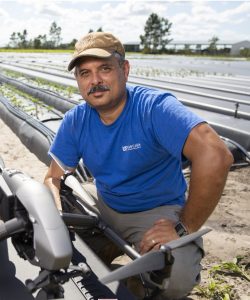
 Where did you study? I studied at the University of Florida.
 Where did you study? I studied in the University of Puerto Rico, Mayagüez Campus (UPRM). I have a Bachelors Degree in Land Surveying and Topography.
 Where did you study?
 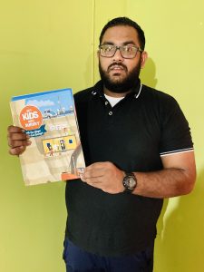 Where did you study? I am a Graduate Geomatics Engineer (Land Surveyor) in my country Trinidad and Tobago. I am a PhD Surveying and Land Information Candidate; I also hold an MSc. Geoinformatics (Distinction), and BSc. Geomatics (Honors)- Chartered Institution of Civil Engineering Surveyors Accredited. I also have 9 years of professional and academic experience.
 Here’s a bit about him:
 If you are not a surveyor, what do you do? Associate Director of Talent Acquisition at Atwell. I am a dedicated resource for our Survey and Mapping group. I am also chair of our survey scholarship program, and I’m launching a Young Surveyor program internally this year. I also plan to become a CST proctor in the next few months.
 Company Name
Please fill out the form below to download our Monopoly Sponsor Info Sheet Download:
Welcoming our latest Brand Ambassador Dustin Gardner from Phoenix, Arizona, USA!
 If you are a surveyor: I originally studied at the University of Nebraska at Lincoln and graduated in 2017 with a BA in American literature, and minors in criminal justice and mathematics. As of Spring 2023 I received an academic certificate from Idaho State University in land surveying.
I am currently living and working in Arizona, and in order to be a professional land surveyor in this state Applicants for registration as a Land Surveyor need 72 months of education/experience and have passed the NCEES fundamentals (FS) and professional (PS) examinations and the Arizona State Specific
examination. However, to start in this field all you need is timeliness and a good attitude. Many surveyors will be delighted to teach you everything they know.
I am a fourth-generation land surveyor. My great grandfather, grandfather, dad, and uncle are all land surveyors. I originally wanted to be in law enforcement and took a job working with my dad. I soon realized I much preferred this profession and took off with it from there. Now after 6 years I’ve worked in 3 different states, I have an academic certificate in survey, and have licenses in two states.
How long have you been in the industry? I have been in the field for 6 years now.
Are you part of any associations or organisations you would like us to mention? I work with the Arizona Young Surveyors Network, and we are up and coming trying to recruit. We’re focusing on communication for young surveyors to network with each other and help each other grow professionally. The other organization is OCJ Kids, which helps foster children across Arizona. We’ve had them involved with us for a few events and have been showing foster children there’s a place for everyone in land surveying!
Why do you want to be a GKiS Brand Ambassador? I believe in our profession vehemently and want to preserve it. I think if kids understood what we do more kids would want to be involved, especially with the growing technology side. I already do a lot with getting kids into survey between the foster kids, Habitat for humanity, and recruiting at colleges, and high schools. I know GKiS already has a powerful base and a large swath of resources, and I’d like to work with others trying to achieve the same goal to be more effective at recruiting.
Why is it important for kids to know about surveying and the wider geospatial industry? Not only is it one of the oldest professions, but it is, and always has been, one of the most important professions. It’s also a wildly vast brush stroke to simply reference geospatial and survey as “a” profession. There is an immeasurable number of specialties within both survey and geospatial professions. When I tell people there’s a home for everyone in “survey” (or geospatial) it isn’t an exaggeration. No matter what your specialty or interest is, there’s some specialty here that you can make a life with. However, these aren’t publicized often, and so most don’t know we exist.
What are you going to do as an ambassador for GKiS? I want to set up programs to teach middle schoolers and younger that we exist, and that this can be a fun career. For Jr. High through college I want to establish learning programs that have practical value that can be translated into experience so when these kids enter the work force, they can hit the ground running and really reach the highest level they possible can in this career. So, the sooner we can teach them basics, the sooner they can develop advanced skills and really take the career to new heights.
What are your hobbies? The largest part of my “hobbies” is researching and reading. Outside of survey, I am a folklorist and historian. Meaning, I study how storytelling (myths, legends, and tales of the people) affected history. I trace stories back as far as I can, hopefully to an origin point, in order to understand our where these stories came from and why they originated. Folklore, history, and land surveying are all the search for fact. I absolutely love reading into our folklore to understand why humans do what we do. I have also been working on compiling a history of land surveying back to the ancient Egyptians. I’ve even found folklore of land surveyors including curses, ghosts, and vampires! I’ve been working on assembling an archive of land surveying texts (both historical and folklore based) to preserve the great history of our profession for future generations.
If you/your company had a GKiS character, what would it be? If I had a GKis Character they’d probably look pretty similar to Indiana Jones with a gunters chain or other antique equipment or an older western 1800’s surveyor. My favorite part of land surveying is the history portion, and my favorite quote is “archeology is the search for fact.” Land surveying is also the truth for fact. So, it goes hand-in-hand. There’s nothing more interesting than pouring over old maps, and part of folklore is tracing the stories to (usually) a truth-based source. So, the idea of old maps and traveling the world to discover ancient historical sites and artifacts and preserving this information for future generations to enjoy was always wildly fascinating and a large base for my interests. Now, I can do this as a career.
What resource would you like to see next from GKiS? I would really like to see some kind of interactive game or app for kids. I think with the way technology and society are going I think you could have a huge following for kids to connect to and learn about the profession remotely. Maybe, small interactive comics if nothing else, but it seems like most kids are glued to their tablets anymore.
Anything else you want to add that you think our audience (surveyors, teachers, parents) would be interested in? I would really like to hand over my (small but growing) historical archive to GKiS, so that everyone can access and add to it. I would like to have some archives set in place so that surveyors throughout time can have information about what we’ve done through time because it’s important. I also think we have a wildly fascinating history. We’ve been involved in some really neat things over the centuries and our profession was largely the same up until the dawn of GPS and laser theodolites.