
 Where did you study?
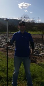 Where did you study? At the Metropolitan Technological University UTEM of Chile
 If you are not a surveyor, what do you do? As SAM Companies’ Early Talent Management Program Lead, my focus is on promoting surveying as a career choice among high schools, vocational schools, colleges, and universities. SAM acknowledges the importance of early talent engagement to attract future surveyors and expand our industry’s talent pool. Through our efforts, we hope to make surveying a household name, discussed around family dinners just as confidently as any other profession!
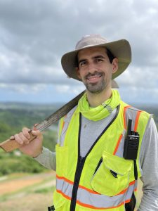 Where did you study?: I’m currently working on my bachelor’s degree at the Polytechnic University of Puerto Rico
 Where did you study?
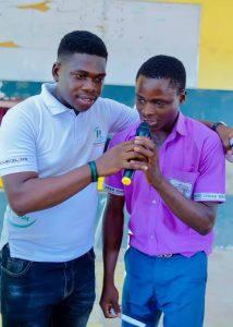
 Where did you study? I studied at the Department of Geoinformatics and Surveying University of Nigeria Nsukka
 Company Name– Drone Pilot Academy Ltd
Please fill out the form below to download our Monopoly Sponsor Info Sheet Download:
Introducing our latest team of Brand Ambassadors from The Conrad Blucher Institute for Surveying and Science (CBI). For enquiries please reach out to Seneca Holland.
If you are not a surveyor, what do you do? The Conrad Blucher Institute for Surveying and Science (CBI) at Texas A&M University – Corpus Christi is an inclusive research environment utilizing geospatial science to support data driven decision making. The institute’s research laboratories develop innovative solutions informed by precise measurements honoring the legacy of the Blucher family and their commitment to surveying and science. CBI pushes the boundaries of geospatial science by applying cutting edge technologies to map, measure, collect and manage big data used to predict our physical environment.
How long have you been in the industry? The Conrad Blucher Institute for Surveying and Science was dedicated on May 6, 1987. We just celebrated our 35th Anniversary!
Are you part of any associations or organisations you would like us to mention? The Conrad Blucher Institute for Surveying and Science supports the Geographic Information Science, Geospatial Systems Engineering and Geospatial Computer Science Programs at Texas A&M University – Corpus Christi. The Institute conducts innovative research and encourages scientists and professional engineers to develop and apply technology solutions relevant to surveying, scientific measurements, and to the issues in the Gulf of Mexico region. The Institute has achieved and maintains a national reputation for developing innovative geospatial science research and serves as a focused resource area for geospatial datasets relevant to the coastal environment.
Why do you want to be a GKiS Brand Ambassador? For more than 35 years, the Conrad Blucher Institute has endeavored to increase awareness of and education in the fields of geospatial engineering and land surveying. We believe that together we can increase awareness of and broaden participation in the fields of geospatial engineering and land surveying. We can also increase preparation and enhance capacity throughout the region to foster and upskill a diverse workforce. By developing a strong coalition of multisector partners and uniting resources with the expertise of a broad range of stakeholders at local and regional levels, we can improve the resiliency of communities and economies throughout Texas.
Why is it important for kids to know about surveying and the wider geospatial industry? The number of skilled professionals entering the geospatial and land surveying fields has steadily declined and high-paying jobs across Texas are going unfilled. The average age of registered professional land surveyors in Texas is 59. With academic programs in land surveying seeing declines in enrollment, it is increasingly difficult to find new surveyors to step into roles left empty by a retiring workforce.
What are you going to do as an ambassador for GKiS? The Conrad Blucher Institute, in collaboration with educational and industry partners, is leading the way in promoting and assisting Texas Independent School Districts (ISDs) in establishing this CTE Pathway. We are creating an educational pathway for K-12 students interested in pursuing a degree or career in the fields of geospatial engineering and land surveying. As part of our efforts with high schools in Texas we will bridge GKiS with the GELS CTE program.
What are your hobbies? Conducting measurement science in the Coastal Bend of Texas.
If you/your company had a GKiS character, what would it be? A hydrographic surveyor on a boat deploying side scan sonar or a Surfing Surveyor.
What resource would you like to see next from GKiS? Instructions and a materials list for activities that can be done with late elementary/middle school students