Introducing Bassey Bassey our latest Brand Ambassador covering the North-West of the UK!
How did you get into surveying? Through formal education. I’ve got a BSc in Geoinformatics and Surveying, University of Uyo and a MSc in Hydrography, University of Plymouth.
What are your plans as a Brand Ambassador? To collaborate with other key players and members is spreading the word about how rewarding pursuing a career in surveying is
Tell us a bit about what you do: I’m currently a graduate Hydrographic Surveyor who’s currently out of work, still job hunting and have a strong passion for Geospatial science.
Ambassador Spotlight ‘Nicole Allen’
Welcoming Brand Ambassador Nicole Allen, who is covering the areas Oregon and Washington in the USA!
What got you into surveying? I started as a civil engineering student at Oregon State University. I loved the surveying classes and took enough to qualify for the LSIT exams. I interned my senior year as a surveyor doing cadastral surveying in the middle of the woods in Washington, in the snow, and still ended up loving surveying and its history.
What are your plans as a Brand Ambassador? I want to expose school aged students to the profession and show them the growing technologies within the field. I want to share my passion and love of the industry while emphasizing its necessity in the world. I also want to share the history of surveying, both good and bad, and how we can move the profession forward in healthy and inclusive way.
Tell us a bit about what you do: I am now a registered professional land surveyor in Oregon and Washington. I mostly work in on public works projects doing topographic, right-of-way, and other resolve work for various public agencies ranging from small counties to state departments of transportation. I was promoted to Public Works Survey Project Manager in 2025 and also do a lot of project estimating, scoping and project management work.
Anything else you’d like to add? I am on a personal journey researching women’s history in the profession with a special interest in native peoples. I also incorporate mapping and fiber arts together as a hobby, which shows how technical fields can also run into art culture/social sciences.
Ambassador Spotlight ‘Björn Pramlid’
Introducing our latest Brand Ambassador Björn Pramlid from Stockholm and eastern parts of Sweden!
How did you get into surveying? True luck. I saw an ad for a surveying education at Högskolan in Gävle on an orienteering competition and decided to try this unknown profession. This was 2006 and I still love the job
What are your plans as a Brand Ambassador? I would like to try to motivate youth to find the surveying business. I think that if more know about our job more will choose this as an education in higher level of studies.
In my role as regional manager i visit student that has chosen our profession to inspire them to complete their education. But i would love to meet the student earlier to make them choose the right education.
Tell us a bit about what you do: I work as an regional manager and have been responsible for marketing och recruiting the past 12 years. I really love the job and it’s frustrating that so few know about this profession.
This lead to that Sweden are undermanned with competent surveyours and we relying on fewer people. I’m convinced that it would only benefit us if more people chose to study to surveyor or similar.
Anything else you’d like to add? In this profession my biggest interests has combined into a job. Maps, Nature, 3d modeling and infrastructure construction.
Ambassador Spotlight ‘Matthew Ek’
Welcoming our latest Brand Ambassador, Matthew Ek from Maine, USA!
How did you get into surveying? Survey internship while attending University of Maine for a Civil Engineering Degree. That hooked me on surveying and I changed my major the next semester.
What are your plans a Brand Ambassador? I loved Math in school and would like to speak with students and teachers, so that they can see surveying as a potential profession.
Tell us a bit about what you do: I’ve been a land surveyor for 38 years, and at the same firm for 33 years. We’ve grown our survey team from 1 PLS with 6 techs to 15 PLS’s with 25 techs. I concentrate now on mentoring our newer, and seasoned, PLS’s. Helping them achieve the their goals and the path that they would like to follow.
Anything else you’d like to add? Surveying is a great career for someone that likes to be outside but still gets to use some of the latest technology. You get to work on different sites and help people what is often their most expensive purchase, their home.
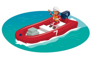
Character Spotlight ‘Subsea7’
Introducing our fabulous Brand Sponsors, Subsea7. Let’s learn some more about them:
1. Company Name – Subsea7
2. Location – Everywhere you can imagine, around the world
3. Why is it important for your company to help Get Kids into Survey? Imagine if we could play an awesome treasure hunt game, but instead of looking for gold, we find cool places on maps and learn about our amazing planet! It’s like being a detective or an explorer! Getting kids into surveying and map-making is like opening a treasure chest of curiosity and fun! It gets them excited about cool subjects like science, technology, engineering, and math (STEM). Plus, it helps them learn awesome skills for the future!
By exploring these fields, kids can become the next generation of super-smart inventors who solve big problems and make the world a better place.
It’s also super important that kids from all different backgrounds join in. This way, we get tons of creative ideas, and everyone has the chance to discover what they love.
4. What do you do? As a Project Surveyor in the offshore energy world, I get to use special tools to discover what’s under the ocean and help create awesome projects. Imagine being an underwater explorer with cool gadgets! My work routinely involves:
Create Treasure Maps: Use sonar to map the ocean floor and find spots for building wind farms and .
Use Amazing Tools: Operate high-tech gadgets like sonar and GPS.
Protect the Ocean: Ensure projects are safe for sea creatures and the environment.
Join Team Adventures: Work with experts to create and protect structures in the ocean.
Analyse Clues: Study data to help plan safe projects.
Isn’t it like an epic underwater quest?
5. How long have you been in the survey industry? Around 11 years, started doing scientific research while in University
6. How did you end up getting into the geospatial industry? When I was a little girl, I loved watching ocean documentaries with my dad. As I got older, I dreamed of becoming one of the cool lady ocean explorers I saw on TV. One day, a big tsunami hit Indonesia, that was a very sad time for many and made me super curious about why and how it happened. That’s when I decided to study Oceanography and got hooked on Geo Sciences.
7. State a funny fact about you… I have my very own collection of awesome rocks and fossils, and it’s my biggest treasure! Some of them come from deep-ocean volcanoes and ancient coral reefs. My coolest fossil is a shark tooth that’s 200 million years old and almost as big as my hand!
8. Favourite piece of kit and why? I love our ROVs, which are super cool underwater robots! They can dive deep into the ocean and have all kinds of awesome gadgets to help explore and map the seafloor. You can even customise them, just like people do with their cars!
9. Favourite Survey technique and why? I love the MBES, which stands for Multibeam Echosounder! It’s a super cool gadget that helps us make really detailed maps of the ocean floor. With it, we can spot shipwrecks, pipelines, and even tiny structures, just like we’re seeing them right in front of us. It’s an awesome tool for exploring the deep sea.
11. How did you choose the character and what’s her name? Sophia “The Surveyor”
Ambassador Spotlight ‘Geoffrey Thomas’
Welcoming latest Brand Ambassador Geoffrey Thomas from Waikato Region of New Zealand! Let’s learn some more about him:
How did you get into surveying? Was introduced to surveying in 2nd year high school by a family friend wanting a chainman over school holidays. This sparked my interest in Surveying and development.
Tell us about what you do: With 20 plus years’ experience, I have worked on large scale projects including wind farms, state highways & residential developments. In my current role I have worked on civil infrastructure projects to help steer & guide Horizontal Direction Drills, monitor railway lines while crews pipe jack & auger bore steel casings underground. I also work with large construction equipment & machine control.
What are your plans as a Brand Ambassador? I get asked all the time by children what I’m taking pictures of when working on the street. But by only having limited time to chat, I can see their curiosity and interest. Growing up I never knew what surveying was until I had some initial work experience. So, by visiting schools, both primary & secondary I can help promote the industry by talking to teachers & passing on resources, I can also do demonstrations of my equipment & talk about my jobs/roles and experiences. And if some are interested i could take them in the field to show what a day in the life of a surveyor is like.
Anything else that you’d like to add? I have coached my nephew’s jr rugby team for the past 4 seasons, so I have experience with younger children. Plus my working experience on unique projects i can provide a different perspective to general surveyors
Ambassador Spotlight ‘Maria Jianu’
Welcome Maria Jianu our latest Brand Ambassador from the Banat region of Romania! Let’s learn some more about her:
How did you get into surveying? I did my studies at Politehnica University of Timisoara, majoring in Geodetical Engineering. Then I continued with my bachelor studies in the field of Cadaster and Land Evaluation. After that I obtained my PhD in Civil Engineering (my thesis research was dam monitoring using topographical technologies and techniques).
What are your plans as a Brand Ambassador? I want to promote Surveying and to make it more attractive for kids because it gives them tools to explore, imagine and connect with the world around them.
Children are naturally curious and when they learn to represent the environment around them, they become adventurous and want to explore.
Also, reading and interpreting a map develops their critical thinking and spatial skills.
Furthermore, it brings passion, creativity and it connects technology with nature, encouraging environmental awareness and inspiring responsible choices.
Tell us a bit about what you do: I teach, at Politehnica University, Surveying for civil engineering students from the study programs: Civil engineering in English language and in German language. And for students from Terrestrial Measurements and Cadastre study programme I teach Photogrammetry and Surveying.
Ambassador Spotlight ‘Kevin Corbley’
Welcoming Brand Ambassador Kevin Corbley who is from Colorado Front Range, USA:
How did you get into surveying? Landsat commercialization
What are your plans as a Brand Ambassador? Helping create a “Get Kids into Geospatial” program.
Tell us a bit about what you do: Geospatial business development, marketing, and public relations.
Anything else you’d like to add? I have given dozens of geospatial career presentations to U.S. middle and high school students.
We use cookies on our website to give you the most relevant experience by remembering your preferences and repeat visits. Read More.
This website uses cookies to improve your experience while you navigate through the website. Out of these, the cookies that are categorized as necessary are stored on your browser as they are essential for the working of basic functionalities of the website. We also use third-party cookies that help us analyze and understand how you use this website. These cookies will be stored in your browser only with your consent. You also have the option to opt-out of these cookies. But opting out of some of these cookies may affect your browsing experience.
Necessary cookies are absolutely essential for the website to function properly. This category only includes cookies that ensures basic functionalities and security features of the website. These cookies do not store any personal information.
Any cookies that may not be particularly necessary for the website to function and is used specifically to collect user personal data via analytics, ads, other embedded contents are termed as non-necessary cookies. It is mandatory to procure user consent prior to running these cookies on your website.
Monopoly Sponsor Info Sheet Download
Please fill out the form below to download our Monopoly Sponsor Info Sheet Download:
Autumn Poster Hotsheet Download
Please fill out the form below to access our Poster Hotsheet:
Summer Poster Hotsheet Download
Please fill out the form below to access our Poster Hotsheet:
Spring Poster Hotsheet Download
Please fill out the form below to access our Poster Hotsheet:
Poster Hotsheet Download
Please fill out the form below to access our Poster Hotsheet:
Re-Print Hotsheet Download
Please fill out the form below to access our Re-print Hotsheet:
Winter Poster Hotsheet Download
Please fill out the form below to access our Poster Hotsheet:
Homework Project Info Pack
Please fill out the form below to access our Homework Project Information Pack:

 What got you into surveying? I started as a civil engineering student at Oregon State University. I loved the surveying classes and took enough to qualify for the LSIT exams. I interned my senior year as a surveyor doing cadastral surveying in the middle of the woods in Washington, in the snow, and still ended up loving surveying and its history.
 How did you get into surveying? True luck. I saw an ad for a surveying education at Högskolan in Gävle on an orienteering competition and decided to try this unknown profession. This was 2006 and I still love the job
 1. Company Name – Subsea7
 How did you get into surveying? Was introduced to surveying in 2nd year high school by a family friend wanting a chainman over school holidays. This sparked my interest in Surveying and development.
 How did you get into surveying? I did my studies at Politehnica University of Timisoara, majoring in Geodetical Engineering. Then I continued with my bachelor studies in the field of Cadaster and Land Evaluation. After that I obtained my PhD in Civil Engineering (my thesis research was dam monitoring using topographical technologies and techniques).
 How did you get into surveying? Landsat commercialization
 How did you get into surveying? Through formal education. I’ve got a BSc in Geoinformatics and Surveying, University of Uyo and a MSc in Hydrography, University of Plymouth.