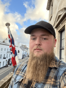
Introducing our latest Brand Ambassador Jack Edwards from Birmingham, UK:
Where did you study? I initially was taught on the job but have since attended The Survey School as apart of their TSA course.
Requirements to be a Surveyor: There are no formal requirements to become a surveyor in the UK.
How did you get into surveying?I fell into it after being convinced by a surveyor friend of mine to apply as an assistant surveyor.
Associations and organisations: Not currently but I am working towards my application for technical membership to the Chartered Institution of Civil Engineering Surveyors.
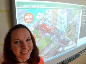
Why are you volunteering? Because I believe it is important for the future of this industry to show young people what surveying is, the importance of it to the world that we live in and the opportunities that a surveying career could provide them.
Why is GKiS important? So that they can learn more about the world that they inhabit and to keep the traditional methods of surveying alive, as these skills are sadly dying out in the UK.
BA plans? I would like to work with young people to show them how interesting surveying can be and to leave an impression on them to the extent that at least a few would like to pursue a career in surveying.
Character Spotlight ‘Uni Of Ljubljana’
Introducing our latest sponsors the Faculty of Civil and Geodetic Engineering at the University of Ljubljana! We are super thankful to the team here who have helped to translate 2 of the geospatial posters (with Q&A sheets) into Slovenian, ready to print and distribute around Slovenia.
Let’s learn some more about them:
1. Company Name –
Faculty of Civil and Geodetic Engineering, University of Ljubljana
2. Location –
Ljubljana, Slovenia
3. How did you choose the character and what does he/she/it represent? Mean to you?What’s his/her name?
I am hen Slavi. In shape, I resemble the outline of our country, Slovenia, with the head on the left and Slovenia on the right. I use high-quality personal protective equipment to ensure the safety and health of employees. Primarily, I assist geodesists and builders from the Faculty of Civil and Geodetic Engineering at the University of Ljubljana in building a sustainable future.
4. Why is it important for your company to help Get Kids into Survey?
Our faculty is the only one in Slovenia offering study programs in geodesy and geoinformatics. We aim to attract more students to these programs because we believe that too many children are unaware of this profession and its fascinating nature.
5. What do you do?
Our primary activity is educating students to become professional geodesists with university qualifications. However, we also engage in other enjoyable activities. We research and test new methods in measuring and presenting spatial data, conduct field measurements of challenging engineering structures such as tunnels and large hydroelectric power plants, and organize excursions worldwide with students to learn new things.
6. How long have you been in the survey industry?
The University of Ljubljana was founded over 100 years ago in 1919. From the beginning, alongside the legal, philosophical, medical, and theological faculties, it had a technical faculty where geodesy was taught.
7. How did you end up getting into the geospatial industry?
Geodesy is one of the oldest sciences globally, with ancient Greek mathematicians already involved in calculating the size and shape of the Earth. Geodesy has been a major discipline taught at the University of Ljubljana since its establishment.
8. State a funny fact about you…
When Yugoslavia dissolved in 1991 and a new country, Slovenia, was formed, they decided its shape would be that of a hen, just like me: https://www.google.com/maps/place/Slovenija/ The last leg touches the sea, the tail features beautiful mountains, and the head lies in the Pannonian Plains.
9. Favourite piece of kit and why?
My favourite tool is the level. It’s the simplest of geodetic instruments but allows for the most precise measurements of height differences. With it, I can determine the elevations of mountain peaks or measure where a river has enough drop for a new hydroelectric power plant.
10. Favourite Survey technique and why?
Of all geodetic measurements, I enjoy working with drones the most. From aerial photographs, I can create beautiful 3D representations of historical objects or assist builders during excavations, foresters in measuring forest growth, and geodesists in drawing new maps.
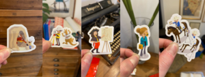
We have many compliments about our cartoon character stickers. As you probably know, when a company sponsor one our geospatial themed posters, they receive a custom character with their branding on. Some of our long standing Brand Ambassadors are lucky enough to have their own characters too!
(you can learn all about the different cartoon characters on our ‘Character Spotlight’ blogs here)
Here is a little selection of the stickers we have left in stock… speaking of which *runs to computer and quickly orders some more custom stickers from Sticker Mule*!!!
If any of our Brand Ambassadors or sponsors wish to print some stickers of their own we are happy to give you the cartoon file for you to order through Sticker Mule. We know it’s good quality and meets our high standards* 🙂 then you can give out stickers to promote surveying… lets get them out far and wide eee!
*Please read through our Brand Guidelines before purchasing, to make sure you are aware of our standards and rules regarding our cartoons/branding. Many thanks.
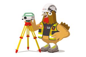
Character Spotlight ‘Wood Rodgers’
Introducing Wood Rodgers our latest sponsor of two re-prints for the West Coast!
Company Name: Wood Rodgers, Inc.
Location: 9 locations throughout Nevada and California
Why is it important for your company to help Get Kids into Survey? Land Surveyors have not done a great job in the past of mentoring young professionals, promoting growth within the profession, or providing public outreach. Get Kids into Survey is now the best, most visible resource we have for promoting the profession.
What do you do? Wood Rodgers is a multidisciplinary firm with experience in a wide range of technical areas which includes Surveying and Mapping, Right-of-Way Surveying, Aerial Mapping (LiDAR & Photogrammetry), Engineering Surveying, Mine Surveying, and Construction Surveying.
How long have you been in the survey industry? Wood Rodgers had been providing civil engineering and surveying services for over 27 years.
How did you end up getting into the geospatial industry? Wood Rodgers wanted to be a one stop shop for services and surveying is a huge technical aspect to help the company providing seamless services to our clients.
Favorite piece of kit and why? Levels, total station, GPS, scanner, drone… whatever the right tool is for the job!
Favorite Survey technique and why? Anything that creates a point cloud, it just never gets old looking at them!
How did you choose the character and what does he/she/it represent? Mean to you? What’s his/her name? The character we chose represents one of our company founders, Rich Wood. Rich was instrumental in creating a company that provides unmatched client service, while encouraging and emphasizing an entrepreneurial atmosphere. With this culture, Wood Rodgers has been able to attract and retain highly talented, experienced, and hardworking professionals due to our commitment of encouraging staff according to their efforts and providing an employee-focused environment.
Ambassador Spotlight ‘Joseph Elwell’
Introducing our latest Brand Ambassador Joseph Elwell from Brownsville, Pennsylvania, USA:
Where did you study? I attended the University of Akron in Akron, Ohio grated in 1972 with a degree in Civil engineering.
What are the requirements to be a surveyor in your area? I have licenses in Ohio where they require a 4-year degree and I have a license in Pennsylvania where they require a 2-year degree.
Both states require 4 years’ experience.
How did you get into surveying? A summer job while I was in High School as a Surveyor helper started my career.
How long have you been in the industry? I have practiced surveying for 50 plus years.
Why do you want to be a GKiS Brand Ambassador? I want to be a GKIS Ambassador to encourage young people to get into the surveying profession.
Why is it important for kids to know about surveying and the wider geospatial industry? Surveying is so cool, and it is a rewarding job that allows you to work in many environments.
What are you going to do as an ambassador for GKiS? As an ambassador I plan to work with the Scouts as a Surveying Merit Badge Counselor.
What are your hobbies? My hobbies are gardening and wood working.
Ambassador Spotlight ‘Dolly Carwile’
Introducing our latest Brand Ambassador Dolly Carwile who is covering Central Florida, USA:
Where did you study? University of Central Florida, Seminole State College, Valencia State College, and Daytona State College
What are the requirements to be a surveyor in your area?
2 tracks
4 year degree in ABET accredited geomatics or closely related field +4 years responsible charge
4 year degree in any discipline with 25 credit hours related to surveying + 6 years responsible charge
How did you get into surveying? I was in a 2 year degree program for architecture and building construction. Surveying was a required course. Instead of competing with the other 250 students in the program for a handful of architectural jobs, I decided to get in to surveying before finishing my degree.
How long have you been in the industry? Since 2004
Are you part of any associations or organisations you would like us to mention?
Florida Surveying & Mapping Society
National Society of Professional Surveyors
Why are you volunteering as a GKiS Brand Ambassador? I love sharing awareness of surveying as most kids (including myself) never hear of surveying as a career.
Why is it important for kids to know about surveying and the wider geospatial industry? Surveying and geospatial information are integral to our everyday lives and the functioning of society at basic levels.
What are you going to do as an ambassador for GKiS? Get into classrooms and share surveying.
What are your hobbies outside of work? Geocaching, hiking, video games, sewing. cigars
If you/your company had a GKiS character, what would it be? There’s already a redhead girl and a cat.
What resource would you like to see next from GKiS? Middle School/Grades targeted material.
Ambassador Spotlight ‘Kris Fairley’
Introducing Kris Fairley from Houston, Texas, USA:
Where did you study? Tyler Junior College
How did you get into surveying?I lucked into surveying, however I knew the first day on the job that I wanted to make a career out of it.
If you are not a surveyor, what do you do?Currently, I work for a survey equipment dealer in Houston, TX
How long have you been in the industry? I have been in the industry for over two decades.
Are you part of any associations or organisations you would like us to mention?I am a member of the Texas Society of Professional Surveyors (TSPS)
Why are you volunteering as a GKiS Brand Ambassador?I enjoy sharing the passion that I have for what I do with the next generations that may not know what surveying is.
Why is it important for kids to know about surveying and the wider geospatial industry?Here in Texas there are fewer and fewer joining the profession.We don’t as a whole advertise to the younger generations.I want to change that and show just how rewarding of a career surveying can be.
What are you going to do as an ambassador for GKiS?As GKIS Ambassador, I want to do as much outreach as possible.I already teach a Boy Scouts Surveying Merit Badge several times per year.
What are your hobbies outside of work?Cooking, DIY projects, and spending time with my teenage son.
If you/your company had a GKiS character, what would it be? I will have to get back to you on that one.
What resource would you like to see next from GKiS?Greater ability to order comic books.My company, AllTerra Central, would probably order them by the hundreds if we could.I would love to be able to hand them out at various outreach events we hold throughout the year.
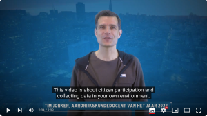
The Netherlands Youth Participation Study
A study on the students own living environment!
As said in this article by geografie.nl :What do young people think of their living environment?
During the week of October 9 to 13, 2023, students aged 10 to 14 years old throughout the Netherlands will collect data about the playgrounds and hangouts in the neighborhood. This introduces them to topics such as citizen participation, geodata and living environment. By participating in this campaign, municipalities or neighborhood associations can take action to make the living environment more fun and beautiful for young people. The students not only experience that their input matters, they also learn to work with Geo-ICT. All they need is a working mobile phone. It fits well with various parts of the curriculum and digital literacy.Students spend approximately 30 minutes collecting the data and a maximum of 1 hour processing the data. Take a look at this YouTube video to learn more!
Netherlands National Youth Participation Campaign:
Inspection of playground and hangout spots- Students collect national data about the chill spots in the neighbourhood, so that the local municipality or neighbourhood association can take action to improve the living environment.
This practical assignment focuses on the theme of ‘involvement and participation’ and the influence you as a citizen can have on your own living environment. Nowadays, an aware and involved resident plays a crucial role in solving social issues. Involvement and awareness are the characteristics of our citizens that help us solve the problems of today and tomorrow sustainably.
Collect data yourself: VI Voluntary Geographic Information, also known as citizen science, is a form of citizen participation. It is the use of tools to create, collect and disseminate geographic data voluntarily provided by individuals in society. Learning to work with digital geographical technology Geo-ICT has now been included in the geography examination program and has therefore acquired a more important position in the school program in recent years. Learning to work with data collected by students themselves is a valuable addition to this. We see the “National Youth Participation Action” as a good investment in smart and involved citizens of the future.
Objectives Completing this assignment ensures that students…
1. look at their daily environment in an active, involved and critical manner.
2. collect their data in an online environment.
3. determine your position on the map.
4. realize that a ‘smart city’ does not exist without smart residents.
5. learn that they are an important part of society.
6. make a valuable contribution to our society.
7. contributing to solutions for social problems.
Instruction Telephone For collecting data, (at least) one telephone is required per group. To determine the location of the chill spot, positioning via the GPS of the phone is the easiest option. A major added value for the national campaign is that photos can be added to the data. Photos add a lot of information to the text and thus clarify the situation. In the context of the GDPR, the intention is that only the chill spot or parts thereof will be included on the map and not (fellow) students or other persons. It is up to the teacher to pay attention to this in advance and afterwards.
Processing of the results, depending on the level, available time and access to computers, different processing assignments and completion can be chosen. Class discussion to view the group’s results on a digital whiteboard. Evaluate the conduct of the inspection. ‘What did you think about it? Did it work well with the app? What did you notice during the inspections? Open the class dashboard and view the results. What stands out about the data? is the image positive, negative or very varied?’ View the photos of a number of chill spots and provide feedback on the inspection.Open the public dashboard and compare the results. Compare the data within a neighbourhood Compare the data within a district. Compare the data within a city Compare the data between cities and towns Compare the data nationally.
Joint action by experts from the KNAG, EduGIS, ESRI and Kadaster:
KNAG: The Royal Dutch Geographical Society is a society for all geographers in the Netherlands and for those who feel connected to the field of geography. The KNAG represents the interests of the discipline of geography and the school subject of geography. The KNAG is now concerned with the development of the subject of geography in education and seeks the connection between education, research, business and geography in practice. Furthermore, KNAG has the knowledge and experience of organizing national events for children (GeoWeek) and a broad network
EduGIS: EduGIS is the platform for geo-related teaching materials to support teachers in the range from Primary to Secondary education (Lower, Middle and Upper School). EduGIS increases students’ awareness of the importance of spatial (read: geo) components (such as topography, land use, demography, etc.) in spatial social issues.
ESRI: Global market leader in geographic information systems technology: GIS. The vision of Esri Netherlands is: “We want to create a world in which everyone, every day, everywhere uses the power of geographic information. Esri Netherlands makes users of geo-information successful by using excellent GIS technology in a valuable way. to make.” As part of its work, Esri offers ArcGIS free of charge to all schools in the Netherlands.
Kadaster: Kadaster makes Geo-Information from various sources of government data usable for all customers and users and puts the user at the center so that everyone can combine information easily and reliably to answer questions, and everyone has insight into the quality of the information.
We use cookies on our website to give you the most relevant experience by remembering your preferences and repeat visits. Read More.
This website uses cookies to improve your experience while you navigate through the website. Out of these, the cookies that are categorized as necessary are stored on your browser as they are essential for the working of basic functionalities of the website. We also use third-party cookies that help us analyze and understand how you use this website. These cookies will be stored in your browser only with your consent. You also have the option to opt-out of these cookies. But opting out of some of these cookies may affect your browsing experience.
Necessary cookies are absolutely essential for the website to function properly. This category only includes cookies that ensures basic functionalities and security features of the website. These cookies do not store any personal information.
Any cookies that may not be particularly necessary for the website to function and is used specifically to collect user personal data via analytics, ads, other embedded contents are termed as non-necessary cookies. It is mandatory to procure user consent prior to running these cookies on your website.
Monopoly Sponsor Info Sheet Download
Please fill out the form below to download our Monopoly Sponsor Info Sheet Download:
Autumn Poster Hotsheet Download
Please fill out the form below to access our Poster Hotsheet:
Summer Poster Hotsheet Download
Please fill out the form below to access our Poster Hotsheet:
Spring Poster Hotsheet Download
Please fill out the form below to access our Poster Hotsheet:
Poster Hotsheet Download
Please fill out the form below to access our Poster Hotsheet:
Re-Print Hotsheet Download
Please fill out the form below to access our Re-print Hotsheet:
Winter Poster Hotsheet Download
Please fill out the form below to access our Poster Hotsheet:
Homework Project Info Pack
Please fill out the form below to access our Homework Project Information Pack:

 Company Name: Wood Rodgers, Inc.
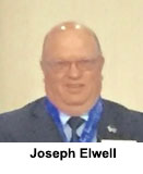 Where did you study? I attended the University of Akron in Akron, Ohio grated in 1972 with a degree in Civil engineering.
 Where did you study? University of Central Florida, Seminole State College, Valencia State College, and Daytona State College
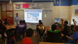
 Where did you study? Tyler Junior College
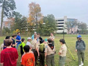
 Where did you study? I initially was taught on the job but have since attended The Survey School as apart of their TSA course.