Please fill out the form below to download our Monopoly Sponsor Info Sheet Download:
-
 Where did you study? University of East London

 Where did you study? University of East London
 Requirements to be a Surveyor: You will either need to go to college/ university or get an apprenticeship
Welcoming our latest Brand Ambassador Paul Tokarczyk from Hibbing area, Minnesota, USA:
 Where did you study? I attended college at Michigan Technological University (Go Huskies!) where I completed Bachelor of Science degrees in Civil Engineering and Land Surveying and a Masters of Engineering in Civil Engineering.
What are the requirements to be a surveyor in your area? To become a licensed land surveyor in Minnesota you must have a 4 year degree in land surveying (or similar) curriculum or a Bachelor’s degree with at least 22 credits in surveying curriculum. Four or more years of experience working under a licensed land surveyor is also required.
How did you get into surveying? I started as an engineering intern on a survey crew and got to see so many different things in the field that I fell in love with it.
How long have you been in the industry? I have been in the industry for more than 25 years starting as an intern carrying stakes after my freshman year of college.
Are you part of any associations or organisations you would like us to mention? I am very active in Cub Scouts and Scouts BSA.
Why do you want to be a GKiS Brand Ambassador? As the geospatial industry keeps changing and expanding, we will need to continue adding people who can continue the work. Kids often don’t realize the kinds of tools and technology that we get to work with and how fun it can be to use these in the variety of work we get to do.
Why is it important for kids to know about surveying and the wider geospatial industry? Surveying and geospatial play a role in so many sectors, including land management, emergency services, mining, facility information, and the military, that it touches many people. Knowledge of what the industry is and can do is useful for kids as they move forward in any career.
What are you going to do as an ambassador for GKiS? I participate in many opportunities to work with youth on STEM events and projects and I like to be able to show them an alternative job that doesn’t involve an office or lab much of the time. Giving them the opportunity to work hands on with the equipment or see it in use is so much fun for me and the youth as well as letting them see how we can apply them to the real world situations they know.
What are your hobbies? Reading, watching sports, Scouts, and being a dad.
If you/your company had a GKiS character, what would it be? If I had a GKiS character, it would definitely be a chameleon. Because working in geospatial I have to be able to change and adapt for many different situations.
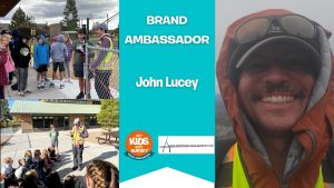
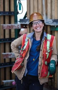
Welcoming our latest Brand Ambassador Carolyn Sotvall who is covering the Greater Seattle area, Washington, USA:
 Requirements to be a Surveyor
How long have you been in the industry?
6 years
How did you get into surveying?
As an apprentice carpenter I was hired and trained by party chiefs at JTM Construction. We perform horizontal and vertical control on our projects using a localized grid tied into property line that correlates to the state plane monumentation used to break down the boundary. We are invested in construction technology including scanning services and AR-VR-Mixed reality solutions. Our internal survey department supports general construction efforts in addition to as built point cloud collection and deliverables for independent contracts. While we are not land surveyors, we are invested in providing opportunities for youth in construction.Edit How did you get into surveying?
Why are you volunteering?
I want kids to know about the opportunities that I missed out on in my youth. I graduated from university and I am still paying off my student loans. I was told that college was the only answer. There are so many more options, particularly for individuals who might not learn in the traditional way.
Why is GKiS important?
We need to teach young people so that we can retire someday. It is our responsibility to pass on the knowledge and skills we have acquired through our own training and experience.
BA plans
I will participate in any way I can. I hope to engage in job fairs, presentations and classroom activities. I would love to bring our tools into the classroom to give kids hands on experience with robotics and laser scanners.
What are your hobbies?
I love the outdoors. I like to hike, ride my bike, I go snowboarding in the winter and paddle boarding in the summer. I love my region because of the biodiversity here. We have mountains and sound, so many opportunities to engage with the natural environment.
GKiS character ideas
James the kid. An incredibly intelligent 6th grader who finds solutions through laser scanning and loves to help his friends learn about construction technology. He is a trailblazer, he can fix anything, he learns how to use tools through good judgement and experimentation. He is fearless, determined and kind and he is a natural born leader.
GKiS resources
Scavenger hunt
Anything else:
I love the Get Kids Into Survey initiative. I would like to contribute to the team by diversifying what is offered. Survey work in construction is now mainstream and there are so many opportunities outside of land surveying.
Meet our latest Brand Ambassador Genique Kemp who is representing the Bahamas! Let’s learn more about her:
 Where did you study? East Tennessee State University- BS Surveying and Mapping Science
Louisiana State University-Shreveport- MBA Project Management Specialization
What are the requirements to be a surveyor in your area? Degree/Diploma in Surveying, 2 years pupillage under a licensed surveyor,
How did you get into surveying? My first summer job at 16 was at my uncles surveying firm. I have been working there ever since.
How long have you been in the industry? 15 years full time.
Are you part of any associations or organisations you would like us to mention? Bahamas Association of Land Surveyors
Why are you volunteering as a GKiS Brand Ambassador? I understand the importance of sparking interest at a young age to inspire the next generation of surveyors and geospatial professionals. The Bahamas, like most other countries are seeing a shortage of surveyors. In order to meet the demand, we have to do our part.
Why is it important for kids to know about surveying and the wider geospatial industry? I think its important to expose them to geospatial careers so they can know the vast options and opportunities out there. Whether they chose a geospatial career or not, its important they know that the option exists.
What are you going to do as an ambassador for GKiS? Attend schools/classes and career fairs.
What are your hobbies outside of work? Tennis and singing
If you/your company had a GKiS character, what would it be? The Island Surveyor. The Bahamas is an archipelago made up of 700 islands and cays. We provide surveying services all across the island chains with no island being too secluded to survey.
What resource would you like to see next from GKiS? Perhaps GeoSquad stickers/buttons/pins to give out after presentations.
Introducing our longstanding sponsor Topcon!
 “Hi, I’m Yumi, the Wild Cat Ninja from Topcon. I’m very excited to get kids into Survey and Civil Engineering…”
Company Name: Topcon Positioning Systems
Location: We are a global company with origins in Japan. Our positioning headquarters are in Livermore, California, which is located just east of the San Francisco Bay.
Why is it important for your company to help Get Kids into Survey? We’re excited to help Get Kids into Survey. Surveying is like a fun adventure that includes cool science, tech, engineering, and math. Learning about it helps you understand how things are arranged in space, includes awesome technology, and gets you ready for jobs and important skills in the future. It’s like a big, fun learning journey for all the kids involved!
What do you do? Our team, called Topcon Positioning Systems, makes really cool technology and tools that support people who build things and grow food. We want to help the world by making sure the surveyors, builders, and farmers have the best tools to do their jobs. With our tools, they can do their jobs easier and faster.
Using our tools, a surveyor can stand in a field and figure out all the details about the land. They measure the length, width, and even the slopes of the land. It’s like making a giant blueprint that shows exactly how the land looks. They help other people know exactly where things should go, like where to build houses, roads, or even where to plant crops. Surveying is like creating a special map that guides everyone on how to use the land in the best way possible!
We also have products that use the information the surveyors gather to automatically control construction and agriculture machinery like bulldozers, excavators, and tractors. This helps those machines perform their tasks so precisely they can get to within a millimeter of their plans.
How long have you been in the survey industry? Our company, Topcon, has been around for over 90 years! We started in Japan in 1932, making surveying and optical equipment, including binoculars and cameras. As we grew, we opened offices around the world and focused more on the surveying equipment and eye exam equipment on the optical side. Starting around 1990, we expanded the surveying side of our business to include technology for construction and agriculture.
How did you end up getting into the geospatial industry? I got interested in protecting my kind because we were in danger. The place where we live was getting ruined, and it was putting us at risk of disappearing. I want to help make the world a better place for everybody, including wild cats.
Land surveyors play an important role in supporting the environment by providing correct information about the land and everything on it. By knowing all the details about the land and its features, like where the hills are or where the rivers flow, land surveyors help others make smart choices to keep our planet healthy.
Surveying uses positioning, and cats are born with a keen sense of position. Like how we consistently land on our feet, we always like to be aware of our exact location at all times. So, being able to work in the geospatial industry was a purrrfect fit for me.
State a funny fact about you… I’m named after a famous ninja who possessed amazing archery skills. My name means “bow” as in bow and arrow. Ninjas are known to be most efficient in doing their work.
Even though I don’t shoot arrows or sneak around like a ninja, I like to think I’ve got my own set of skills. Cats are known for being pretty nimble and quick, just like ninjas! I bring a bit of those ninja-like talents into my daily adventures. After all, a cat named after a ninja has to live up to a little bit of that legendary reputation, right?
Favourite piece of kit and why? I like anything that uses GNSS since I always like to know where I am. GNSS means Global Navigation Satellite Systems, and it uses signals from satellites to determine your location on Earth accurately. It’s very similar to GPS (Global Positioning System), which you might know from your family cars or cell phones. GPS uses a group of satellites to tell you exactly where you are. GNSS uses GPS along with an even bigger group. It’s like a family of different satellite systems from around the world, not just the GPS one. There are others, like GLONASS from Russia, Galileo from Europe, and BeiDou from China. They all work together to help you know where you are, no matter where you are on Earth. And since GNSS uses even more than just satellites, it’s more accurate and reliable.
Whether they’re measuring land, building things, or growing crops, our customers rely on our tools that use GNSS to work faster and get things done really well!
Favourite Survey technique and why? Laser scanning. It’s like a super-fast camera that can capture thousands of points every second. This is really helpful because it means the scanner can collect lots of information quickly, even if it needs to scan a big area. So, if you want to gather data about a large place, like a park or a building, the laser scanner can do it quickly and easily. And, as you might know, cats LOVE lasers.
Remember to check out our Homework Project, The Road To Success! Available to print out for free on GKiS Resources Page.
Welcoming Joseph Pannel to the Brand Ambassador family, who is covering the Southeast US region, specifically Mississippi:
 Where did you study? On the job experience.