
 Company Name: DDK Positioning
 How did you get into surveying?
 How did you get into surveying?
  1. Company Name –
 How did you get into surveying?
  Where did you study?
 Why is it important for kids to know about surveying and the wider geospatial industry?
 How did you get into surveying?
 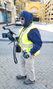 Christopher has had 25 years in the survey business.
Please fill out the form below to download our Monopoly Sponsor Info Sheet Download:
Welcoming our latest Brand Sponsor, DDK Positioning who feature on the Winter Poster! Let’s learn some more about them:
 Company Name: DDK Positioning
- Location: Aberdeen, UK
- Why is it important for your company to help Get Kids into Survey? Here at DDK, we love all things GNSS, Positioning and Survey. We are committed to inspiring the next generation and filling them in on the exciting prospects the industry has. We have a couple of STEM ambassadors within the team who attend several events to raise awareness of the industry too.
- What do you do? Here at DDK Positioning we are bona fide GNSS nerds. In fact, we’re so nerdy we even say “GNSS” rather than “GPS” even though very few folks will know what that is without Googling it! But we do like to be precise…after all, that is our job!
So aside from being very pedantic what do we do? Well, we’re a small company based in Aberdeen that provides a Precise Point Positioning service which takes the normal GNSS accuracy of around 10m down to 5cm. See what we mean about being precise?
This is all made possible by our clever algorithms (developed by our clever people) and our strategic partnerships (agreed by everyone’s strategic people). We deliver our service over the Iridium satellite constellation, which gives us many advantages over our competitors and provides the end users an alternative offering to what they’re used to. After all, everyone likes to have a choice, don’t they?
- How long have you been in the survey industry? DDK Positioning was established in 2016, however we have a number of team members that have been in the survey industry longer.
- How did you end up getting into the geospatial industry? We believe things can be done in a better way, so we’re always looking to challenge the norm. That belief is where DDK came from and why we deliver over positioning service using Iridium’s satellite constellation, ensuring we can precisely position assets globally. FUN FACT: We can position assets in the North Pole too – hopefully the elves will use our service for tracking Santa’s sleigh!
- Favourite piece of kit and why? Our service and X3 hardware is of course our favourite piece of kit and they work together like peanut butter and jam! Without our GNSS positioning service being delivered using our snazzy X3 receiver we wouldn’t be able to position assets as precisely as we would like!
- Your website
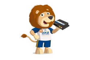
- How did you choose the character and what does he/she/it represent? Mean to you? What’s his/her name? Introducing LEO the Lion, some of you might be wondering why we called him LEO…of course, he’s named after Low Earth Orbit (LEO for short); why? Well, we do precise positioning using Low Earth Orbit Satellites in space!