
 How did you get into the geospatial industry? I am Leica Geosystems distributor and accredited laboratory for surveying instruments. We also distribute other brands: South-Sanding, CHC-Geomate, Geomax, Satlab, etc.
 At Get Kids into Survey (GKiS), our Brand Ambassadors are at the heart of everything we do. They are volunteers, advocates, and role models. Taking geospatial careers into classrooms, careers fairs, community groups, and online spaces across the world.
 How did you get into surveying? I got into the Geospatial Industry back in 2017 when my boss at the time said he wanted to bring terrestrial scanning. I was only a few years into my surveying career, and he asked if I was interested in leading the efforts to bring this new technology to the Colorado offices and region. I told him I’d never done something like that before but was very interested and would give it my all. Boy, am I glad I said yes to that opportunity.
 How did you get into surveying? For my undergraduate degree, I studied for a Bachelor of Engineering in Geomatics engineering. After successfully completing my studies, I worked as a Surveyor in both public and private corporations.
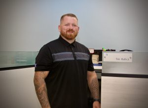 How did you get into surveying? Land Surveying since 2015. 5th generation Land Surveyor.
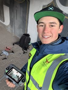 How did you get into surveying? I bought my first drone form §100. Now I’m 18 and scanning 150 cell towers across entire Bulgaria using photogrammetry and drones.
 How did you get into surveying? When I was young, my uncle was a land surveyor and always had the latest and greatest technology. As a middle schooler, I thought he was one of the coolest adults I knew. When my parents would travel out of town during the week, I would stay at my aunt and uncle’s house. I would try not to get caught looking over my uncle’s shoulder while he was catching up on miscellaneous drafting tasks in CAD. One day, my uncle had me help him with a level loop, and I was hooked.
Please fill out the form below to download our Monopoly Sponsor Info Sheet Download:
Introducing Aheebwa Phinan our Brand Ambassador from Central Region of Uganda!
 How did you get into surveying? I got into the geospatial industry through my studies in Land Surveying and Geomatics Engineering. What started as a university course quickly turned into a genuine interest once I saw how mapping and spatial data are used to solve real problems on the ground. Through practical fieldwork, GIS projects, and community mapping activities, I realized the power of geospatial tools in land management, planning, and development. That experience pushed me to keep learning and sharing this knowledge beyond the classroom.
What are your plans as a Brand Ambassador? As an ambassador, my goal is to introduce more young people in East Africa to surveying and geospatial careers in a simple and relatable way. I plan to work with schools, universities, and youth groups to create awareness through talks, workshops, and online engagement. I want to help students, teachers, and parents understand what surveying is, why it matters, and how early exposure can open long-term opportunities. I also aim to represent the brand locally by connecting it to real educational and community needs in the region.
Tell us a bit about what you do: I work in the geospatial field with a focus on GIS, mapping, and spatial analysis. My work involves land surveying tasks, digital mapping, WebGIS projects, and applied research. I also spend a lot of time training and mentoring students, helping them understand GIS tools and how spatial data connects to real-world challenges. Alongside technical work, I am actively involved in student and community initiatives that promote geospatial education and practical skills development.
Anything else you’d like to add? In many parts of East Africa, surveying and mapping are rarely discussed with children, yet they play a major role in land ownership, infrastructure, and development. There is a strong need for simple, practical resources that explain these ideas at an early age. I believe Get Kids Into Survey can have a real impact here by sparking curiosity and showing young learners that mapping is not just about maps, but about understanding and improving the world around them.