
Introducing our longstanding sponsor Topcon!
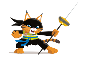 “Hi, I’m Yumi, the Wild Cat Ninja from Topcon. I’m very excited to get kids into Survey and Civil Engineering…”
Company Name: Topcon Positioning Systems
Location: We are a global company with origins in Japan. Our positioning headquarters are in Livermore, California, which is located just east of the San Francisco Bay.
Why is it important for your company to help Get Kids into Survey? We’re excited to help Get Kids into Survey. Surveying is like a fun adventure that includes cool science, tech, engineering, and math. Learning about it helps you understand how things are arranged in space, includes awesome technology, and gets you ready for jobs and important skills in the future. It’s like a big, fun learning journey for all the kids involved!
What do you do? Our team, called Topcon Positioning Systems, makes really cool technology and tools that support people who build things and grow food. We want to help the world by making sure the surveyors, builders, and farmers have the best tools to do their jobs. With our tools, they can do their jobs easier and faster.
Using our tools, a surveyor can stand in a field and figure out all the details about the land. They measure the length, width, and even the slopes of the land. It’s like making a giant blueprint that shows exactly how the land looks. They help other people know exactly where things should go, like where to build houses, roads, or even where to plant crops. Surveying is like creating a special map that guides everyone on how to use the land in the best way possible!
We also have products that use the information the surveyors gather to automatically control construction and agriculture machinery like bulldozers, excavators, and tractors. This helps those machines perform their tasks so precisely they can get to within a millimeter of their plans.
How long have you been in the survey industry? Our company, Topcon, has been around for over 90 years! We started in Japan in 1932, making surveying and optical equipment, including binoculars and cameras. As we grew, we opened offices around the world and focused more on the surveying equipment and eye exam equipment on the optical side. Starting around 1990, we expanded the surveying side of our business to include technology for construction and agriculture.
How did you end up getting into the geospatial industry? I got interested in protecting my kind because we were in danger. The place where we live was getting ruined, and it was putting us at risk of disappearing. I want to help make the world a better place for everybody, including wild cats.
Land surveyors play an important role in supporting the environment by providing correct information about the land and everything on it. By knowing all the details about the land and its features, like where the hills are or where the rivers flow, land surveyors help others make smart choices to keep our planet healthy.
Surveying uses positioning, and cats are born with a keen sense of position. Like how we consistently land on our feet, we always like to be aware of our exact location at all times. So, being able to work in the geospatial industry was a purrrfect fit for me.
State a funny fact about you… I’m named after a famous ninja who possessed amazing archery skills. My name means “bow” as in bow and arrow. Ninjas are known to be most efficient in doing their work.
Even though I don’t shoot arrows or sneak around like a ninja, I like to think I’ve got my own set of skills. Cats are known for being pretty nimble and quick, just like ninjas! I bring a bit of those ninja-like talents into my daily adventures. After all, a cat named after a ninja has to live up to a little bit of that legendary reputation, right?
Favourite piece of kit and why? I like anything that uses GNSS since I always like to know where I am. GNSS means Global Navigation Satellite Systems, and it uses signals from satellites to determine your location on Earth accurately. It’s very similar to GPS (Global Positioning System), which you might know from your family cars or cell phones. GPS uses a group of satellites to tell you exactly where you are. GNSS uses GPS along with an even bigger group. It’s like a family of different satellite systems from around the world, not just the GPS one. There are others, like GLONASS from Russia, Galileo from Europe, and BeiDou from China. They all work together to help you know where you are, no matter where you are on Earth. And since GNSS uses even more than just satellites, it’s more accurate and reliable.
Whether they’re measuring land, building things, or growing crops, our customers rely on our tools that use GNSS to work faster and get things done really well!
Favourite Survey technique and why? Laser scanning. It’s like a super-fast camera that can capture thousands of points every second. This is really helpful because it means the scanner can collect lots of information quickly, even if it needs to scan a big area. So, if you want to gather data about a large place, like a park or a building, the laser scanner can do it quickly and easily. And, as you might know, cats LOVE lasers.
Remember to check out our Homework Project, The Road To Success! Available to print out for free on GKiS Resources Page.